Summary
This thesis addresses the question:
How would the integration of autonomous systems and artificial intelligence (AI) in the Royal Australian Navy's (RAN) hydrographic capability impact workforce transformation?
Driven by the strategic imperatives of the 2023 Defence Strategic Review (DSR) for a 'Strategy of Denial' in the Indo-Pacific, the RAN is shifting from traditional crewed survey ships to a future capability reliant on uncrewed systems and AI-driven data analysis. The thesis argues that this technological leap necessitates a profound and disruptive workforce transformation that extends beyond mere retraining.
This transformation involves a fundamental shift in the professional identity of the hydrographic specialist from a traditional mariner to a technologist, which is, a systems operator and data analyst skilled in robotics and AI interpretation. This evolution creates significant challenges in skill acquisition, training, recruitment, and retention. Success is contingent on the RAN's ability to create new career pathways, foster a culture that values technical mastery, develop new operational concepts for Human-Machine Teaming, and align naval doctrine with this new reality. Ultimately, the thesis concludes that successfully navigating this change is a prerequisite for realising the full operational potential of an autonomy-enabled hydrographic capability.
Introduction
The strategic landscape of the Indo-Pacific region is characterised by increasing complexity and contestation, demanding that the Australian Defence Force (ADF), and specifically the Royal Australian Navy (RAN), leverage technological advancements to maintain a capability edge.1 The 2023 Defence Strategic Review (DSR) and the subsequent 2024 National Defence Strategy (NDS) unequivocally mandate the adoption of disruptive technologies, with Robotics, Autonomous Systems, and Artificial Intelligence (RAS-AI)2 identified as a critical priority to support a 'Strategy of Denial'.3 Within this broad strategic directive, the modernisation of the RAN’s hydrographic capability (i.e. the science of measuring and describing the physical features of oceans, seas, coastal areas, lakes, and rivers4), emerges as a foundational enabler for maritime operations and national security. This thesis confronts the pivotal challenge accompanying this technological leap: the profound impact on the RAN’s specialist hydrographic workforce.
The core research question guiding this inquiry is: How would the integration of autonomous systems and artificial intelligence (AI) in the Royal Australian Navy's hydrographic capability impact workforce transformation? The central argument presented is that the introduction of Autonomous Underwater Vehicles (AUVs), Uncrewed Surface Vessels (USVs), and AI-driven data analytics into the Navy's hydrographic survey missions and data processing—a direction already set by strategic guidance and capability development plans5—necessitates a fundamental and potentially disruptive transformation of the RAN’s workforce. The RAN’s own RAS-AI Strategy 2040 and its accompanying RAS-AI Campaign Plan 2025 articulate a vision for harnessing these technologies across the fleet, including for hydrographic and geospatial support functions.6 This transformation extends beyond mere technical retraining; it involves a shift in roles, responsibilities, career pathways, and the very conceptualisation of hydrographic expertise within a naval context. The level of detail required to address and operationalise such matters will not be dealt with in this thesis however, broad principles and themes will.
Hydrography, traditionally a discipline reliant on crewed survey vessels and meticulous manual data collection and processing, provides the essential geospatial intelligence for safe navigation, maritime trade, resource management, disaster relief, and, critically for Defence, the geospatial intelligence enabling naval operations. As the Australian Hydrographic Office (AHO) notes, ‘hydrographic information underpins every activity that occurs on, under or over the sea.’7 The accuracy and timeliness of hydrographic data are paramount for anti-submarine warfare, amphibious operations, mine countermeasures, and ensuring access for naval forces. However, traditional methods are often resource-intensive, time-consuming, and can expose personnel to risk in contested or hazardous environments.
The allure of autonomous systems8 and AI in this domain is compelling; in fact, autonomous hydrographic and mine-counter-measure systems acquisition (Project SEA 1905) was underway until it was cancelled due to competing funding pressures.9 AUVs and USVs offer the potential for persistent, wide-area surveillance, rapid data acquisition in denied or dangerous waters, and reduced personnel exposure. AI and machine learning (ML) algorithms promise to accelerate data processing, identify anomalies, and potentially automate aspects of chart production, thereby compressing the ‘data acquisition to user’ timeline and enhancing decision support.
However, any transition from established, human-centric methodologies to an autonomy-enabled hydrographic capability has its challenges, particularly concerning the workforce. This thesis posits that the successful integration of these advanced technologies is not merely a matter of procurement and technical implementation. Instead, successful integration would hinge on the RAN's ability to effectively manage a complex workforce transformation. It would involve shifting hydrographic personnel from traditional hands-on surveying roles to new functions centred on remote system supervision, mission planning for autonomous assets, advanced data analysis, interpretation of AI-generated outputs, and the maintenance of complex software-intensive systems.
Several corollary questions flow from the central research question. How effectively can the RAN manage the transition from legacy platforms, such as the recently decommissioned Leeuwin and Paluma class survey vessels,10 to a more distributed and (in the future) autonomous system-based capability, given current workforce structures, training pipelines, and skill demographics? How does the increasing reliance on industry partnerships, exemplified by the Hydrographic Industry Partnership Program (HIPP), impact the development and retention of sovereign military hydrographic expertise and the overall workforce composition? Furthermore, while this thesis will focus primarily on workforce transformation due to word constraints, it acknowledges the interconnectedness of policy, doctrine, and regulatory frameworks: are these existing structures sufficiently agile and aligned to support this rapid technological shift and the new operational concepts it enables?
Research Method
This thesis employs a qualitative research methodology, utilising a combination of document analysis, and comparative case studies of allied experiences. This approach is well-suited to exploring the complex, multifaceted nature of workforce transformation in a technologically evolving military organisation.
To address gaps in understanding within the existing policy and academic scholarship, this thesis synthesises insights from primary and secondary sources, including strategic policy documents,11 legal sources,12 technical literature,13 academic journals,14 reports and publications from defence research institutions and think tanks.15 It will also draw upon publicly accessible statements and information released by Defence and industry stakeholders,16 including reports from parliamentary committees and the Australian National Audit Office (ANAO) as well as publications from national and international hydrographic bodies.17 These insights are then combined with empirical and theoretical insights derived from the experiences of allied countries and organisational theory to illuminate the path ahead.
With respect to the comparative case study, this is undertaken later in Chapter 4 and will focus on the experiences of key allied navies, specifically the United Kingdom’s Royal Navy (RN) and the United States Navy (USN). These two navies were selected because they are significantly investing in autonomous systems for hydrographic and related mine countermeasures (MCM) capabilities. Examining their approaches to workforce adaptation, training reforms, integration challenges, and lessons learned can, therefore, provide valuable insights and potential best practices relevant to the RAN's context.
A few caveats are worth noting here. First, this research relies almost entirely on publicly accessible information. While this presents a limitation in terms of accessing classified or commercially sensitive internal Defence planning documents, the wealth of available public information, including detailed strategic guidance and reports on technological advancements (including in the commercial hydrographic surveying industry), provides a robust foundation for this thesis’s inquiry. Second, the rapidly evolving nature of autonomous systems technology and the dynamic strategic environment mean that this analysis will necessarily represent a snapshot in time, current as of October 2025. Engaging in an accurate assessment of the long-term effectiveness of initiatives like HIPP is also constrained by their relative novelty and associated commercial sensitivities. Finally, this thesis’s scope is deliberately focused on the RAN's hydrographic capability and its associated workforce transformation. It excludes detailed technical analysis of specific autonomous platforms or the broader complexities of international maritime law governing autonomous vessels, beyond their contextual relevance to workforce roles and training.
Aims and significance
This research aims to provide a holistic analysis of the complex workforce transition needed to coordinate and align people, processes and technology for future strategic readiness. It seeks to move beyond a purely technological or strategic assessment to explore the human dimension of hydrographic modernisation. The significance of this thesis lies in its direct relevance to current Defence priorities and its potential to inform policy and practice within the Royal Australian Navy (RAN). The workforce implications of the Navy's shift from traditional hydrographic platforms to deployable capabilities, managed by small teams known as Deployable Geospatial Support Teams (DGSTs), have been substantial. Utilizing equipment and capabilities acquired through Project SEA 1770 (Rapid Environmental Assessment (REA)), understanding these workforce implications is crucial to avoiding capability gaps and ensuring the full realization of the promised benefits of autonomy. Regarding the acquisition and use of future autonomous capabilities, such as those under potential future projects like the cancelled Project SEA 1905 - Maritime Mine Countermeasures and Hydrographic Capability, understanding the workforce implications will become even more critical to prevent capability gaps and ensure the promised benefits of autonomy are fully realized.
This thesis’s originality further lies in its specific focus on the RAN's hydrographic workforce transformation within the broader context of autonomy and AI adoption. While existing the literature (as reviewed in Chapter 1) often addresses the technological aspects of AUVs/USVs or the strategic implications of RAS-AI, a comprehensive analysis of the human capital challenges confronting a specialised branch like hydrography in the RAN remains significantly less developed. Practically, the findings of this research aim to be of value to Defence planners, capability managers, human resource specialists, and training authorities involved in shaping the future of the RAN’s hydrographic service and, by extension, its overall operational effectiveness.
Thesis Structure
This thesis proceeds in eight chapters, including the Conclusion. Chapter 1 examines the evolving context for the RAN’s hydrographic capability, with Chapter 2 then examining the strategic drivers that underlie the need to modernise hydrography. Chapters 3 and 4 provide examinations of the various new technologies relevant to modern hydrography and allied experiences with such technologies. Chapter 5 provides a detailed analysis of the workforce transformation challenges, with Chapter 6 reflecting on what the supporting ecosystem needs to look like, before turning in Chapter 7 to how this workforce transformation should be supported by stronger policy, doctrine and regulatory alignments. Here, achieving productivity gains from the integration of new technologies requires significant adaptation in workforce structures, including how the RAN plans, trains, and develops its people. The Conclusion summarises the key findings of this thesis, reiterating the importance for the RAN to ensure that advances in technology are not viewed as replacements for personnel but as tools to enhance their capabilities and productivity.
Chapter 1: The Evolving Landscape of RAN Hydrographic Capability
This chapter details the historical mandate of the Australian Hydrographic Service (AHS), and its evolution. It also examines traditional platforms and methodologies of collecting hydrographic data,18 focusing on the recently decommissioned Leeuwin and Paluma classes.19 These classes represent the last of ship or platform centric hydrographic capability. A significant portion of this chapter is dedicated to analysing the RAN’s strategic decision to transition towards new capabilities, including a brief account of the role and implications of the Hydrographic Industry Partnership Program (HIPP) and the divestment from sovereign survey platforms.
Literature Review
The existing body of literature underscores the transformative potential of autonomous systems and AI in the maritime domain. Studies on AUVs and USVs highlight their increasing sophistication, endurance, and ability to gather high-resolution data in diverse and challenging environments.20 The strategic impetus for adopting such technologies is well-documented, particularly in the context of great power competition and the need for persistent maritime domain awareness.21 The RAN’s strategic documents, including the DSR, NDS, and RAS-AI Strategy, clearly articulate this imperative.
Existing scholarship also touches upon the challenges of integrating these new technologies. These include technical hurdles, data management complexities, ethical considerations (particularly for AI in decision-making), and the need for new operational concepts.22 However, a specific and in-depth focus on the workforce transformation required within a niche capability like naval hydrography is less prevalent. While some works discuss the general need for upskilling personnel for an AI-enabled future,23 or the challenges of Human-Machine Teaming (HMT),24 the granular detail of how a specific naval specialisation like hydrography must adapt its recruitment, training, career progression, and organisational structure is an area ripe for further investigation. This thesis aims to address this specific lacuna (in publicly available information), focusing on the RAN's unique context, including its reliance on the HIPP and the operational demands of the Indo-Pacific region.
History and evolution
The RAN Hydrographic Service was formally established on 1 October 1920.25 Its origins, however, are intertwined with the British Admiralty Hydrographic Office, which undertook extensive surveys of Australian waters throughout the 19th century to support both colonial defence and burgeoning commercial development.26 While the RAN assumed responsibility for hydrographic surveys in 1920, the formal responsibility for the publication of charts was taken on in 1942. Early survey work, even predating the official formation, was conducted by vessels such as HMAS Una in 1915, followed by pioneering efforts by ships like HMS Fantome and HMAS Geranium.27
The Australian Hydrographic Office (AHO)28 is the nation's primary hydrographic authority, shouldering the immense responsibility of charting an area that covers more than one-eighth of the world's surface.29 This mandate encompasses a critical dual function: supporting civil maritime safety under international conventions such as the Safety of Life at Sea (SOLAS) and national legislation like the Navigation Act 2012 (Cth), while simultaneously providing essential geospatial intelligence for Australian Defence Force (ADF) operations.30 The AHO's mission explicitly includes enabling safe navigation, supporting Australia's defence and national infrastructure, and fulfilling international obligations for navigational safety and marine environmental protection.31
The strategic importance of this capability was starkly demonstrated during the Second World War. The RAN Hydrographic Branch underwent a significant expansion, playing a vital role in supporting Allied operations in the South West Pacific Area by producing over 1.5 million chart impressions and conducting surveys, often under hazardous conditions.32 This historical precedent underscores hydrography's long-standing criticality to national defence. The enduring dual-purpose nature of Australian hydrography—serving both national civilian requirements for trade, resource management, and safety, and critical military operational needs—highlights its foundational importance.
For decades, the RAN's hydrographic capability was delivered through traditional methodologies, primarily reliant on crewed survey vessels undertaking meticulous, often protracted (many months), data collection and manual processing campaigns. These methods, while foundational, are inherently resource-intensive in terms of personnel, time, and operational costs, and could expose naval personnel to risks, particularly in contested or hazardous maritime environments.
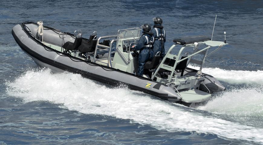
The backbone of the RAN's inshore survey capability for over three decades was the Paluma-class Survey Motor Launch. Four of these 36.6-metre catamarans—HMAS Paluma (A01), Mermaid (A02), Shepparton (A03), and Benalla (A04)—were commissioned between 1989 and 1990.33 Designed specifically for hydrographic operations in the shallow waters of northern Australia, including the Great Barrier Reef, their twin hulls offered stability, high manoeuvrability, and a shallow draught of approximately 2.2 to 2.65 metres, which allowed access to reef-strewn and coastal areas. They were equipped with sensors such as the ELAC LAZ 72 side-scan sonar and a Skipper 113 hull-mounted scanning sonar. Beyond routine surveys, these vessels conducted wreck searches, supported the installation and maintenance of shore-based tracking stations, participated in United Nations operations in East Timor, and provided aid to civil communities.34 The progressive decommissioning of the Paluma class (HMAS Paluma and Mermaid in September 2021, followed by HMAS Shepparton and Benalla in June 2023) marked a significant step in the transition towards new systems, which was (until cancelled) explicitly linked to the introduction of modularized deployable capabilities able to be deployed on future vessels (such as the Offshore Patrol Vessel) under Project SEA 1905-1.35 Due to the cancellation of Project SEA 1905 and the acquisition of advanced autonomous capabilities that project promised, the RAN (and Defence) has effectively delayed its hydrographic (and mine-counter-measures) technological transition to autonomy.
For deeper and more extensive offshore survey tasks, the RAN operated two Leeuwin-class Survey Ships (AGS): HMAS Leeuwin (A245) and HMAS Melville (A246), both commissioned in May 2000.36 These 71.2-metre monohulls were significantly more capable, equipped with multi-beam echo sounders (Atlas Fansweep), single-beam echo sounders (Atlas Hydrographic Deso), a C-Tech CMAS forward-looking sonar, and could embark and support an AS350B Squirrel helicopter and three 9-metre survey motor boats.37 Designed to survey a combined 10,000 square nautical miles per annum, their roles extended beyond hydrography to include support for Mine Countermeasures (MCM) operations, maritime surveillance, disaster relief, Search and Rescue (SAR), and emergency medical assistance.38 The strategic pivot towards new capabilities led to the decommissioning of HMAS Melville on 8 August 2024, leaving HMAS Leeuwin as the RAN’s sole remaining dedicated hydrographic survey ship.39 This reduction in organic, crewed survey platforms underscores the commitment to a new operational model.
The divestment from these legacy platforms was driven in part by their inherent limitations in the context of evolving strategic demands and technological possibilities. While highly effective for their era, their operational tempo, reliance on substantial crews,40 and the risks associated with deploying crewed platforms in potentially hostile areas became increasingly misaligned with the strategic direction emphasizing speed, persistence, reduced human exposure, and cost-effectiveness (especially when the national charting obligations can be met under the Hydrographic Industry Partnership Program (HIPP) discussed below). The decision to retire these vessels is thus a clear manifestation of a fundamental capability shift, moving away from traditional, human-centric survey methods41 towards a more distributed, agile team-based capability, autonomous (in the future) and industry-supported hydrographic enterprise.
The following table offers a comparative overview of the key characteristics of these legacy platforms against the attributes of the emerging autonomous systems that are central to the RAN’s (future) hydrographic modernisation:
| Characteristic | Legacy Systems (e.g., Leeuwin/Paluma-class) | Emerging Systems (e.g., AUVs/USVs) |
|---|---|---|
| Primary Staffing | Crewed (significant complement) | Present: Multiple small deployable teams (i.e., DGSTs) Future: Small deployable teams operating multiple uncrewed or minimally crewed/remotely operated capabilities43 |
| Typical Endurance/Persistence | Days to weeks (limited by crew fatigue, fuel, stores) | Teams remain limited by fatigue, stores, however, systems may autonomous systems may operate for days, weeks, or months (limited by power, system reliability)44 |
| Data Acquisition Rate/Area Coverage Speed | Moderate; sequential survey lines by parent vessel or Survey Motor Boats (SMBs) | Potentially higher in the future due to multiple autonomous assets operating concurrently; persistent operations |
| Suitability for Contested/Denied Environments | Higher risk to personnel and capital-intensive platforms | Potentially lower risk to personnel; smaller, potentially more expendable or stealthier platforms; rapid deployment capability |
| Primary Data Collection Method | Hull-mounted or towed sonars on crewed vessels/boats | In the future, offboard autonomous sensors on AUVs/USVs; remote sensing |
| Reliance on Sovereign Platform vs. Industry | Primarily sovereign platforms for all survey tasks (i.e., both national and military ‘survey’ tasks | Increased reliance on industry partnerships (HIPP) for national survey tasks; sovereign focus on military Geospatial Intelligence (GEOINT) |
A significant element in the evolving landscape of Australian hydrography is the Hydrographic Industry Partnership Program (HIPP). Prior to the introduction of the HIPP, the greatest changes to the conduct of hydrographic surveying were in tactical efficiencies flowing from technological change, such as the introduction of the Global Positioning System (GPS), which enabled the rapid and accurate positioning of hydrospatial data. The HIPP program however, represents a strategic shift in how Australia meets its national hydrographic survey obligations,45 moving towards a model of increased collaboration with commercial industry (whatever the technologies in use). HIPP is a commercial initiative through which the Department of Defence partners with specialist hydrographic survey companies to ‘undertake focused survey activities that contribute to national charting priorities.’46 The stated vision for HIPP is to establish ‘an efficient, effective and sustainable hydrographic survey, oceanographic and marine geophysical data collection program through a partnership with Industry to deliver a true nation-building effort.’47 Compared to the divested/divesting RAN ship based surveying capability, industry partners are generally able to achieve three times the rate of effort (i.e., three times the amount surveyed). This is largely due to the high degree of specialization in task (i.e., surveying is not diluted by non-surveying military activities and taskings) and the ability of industry to utilize the most cost effective and efficient technologies available and suitable for a given tasking. A key objective is to achieve full, high-quality bathymetric coverage of Australia's Exclusive Economic Zone (EEZ) by 2050.48 Industry is also well placed to test and evaluate commercial off the shelf autonomous systems and machine learning software and associated systems in a very agile way.
The program was initiated with a $150 million government investment over five years from 2020, and the 2024 Integrated Investment Plan indicates a further commitment of approximately $1 billion over the decade from 2024 for HIPP to continue collecting data for nautical charts and publications.49
The AHO (as part of the Australian Geospatial Intelligence Organisation (AGO)) manages HIPP on behalf of the Department of Defence, with stakeholder agreement on survey priorities and areas facilitated through the Hydrographic Review Board, which includes representatives from the AHO, the Australian Maritime Safety Authority (AMSA), the Australian Antarctic Division, and Geoscience Australia.50 The implementation of HIPP, which has been in full operation for over five years, has had profound implications for the RAN’s hydrographic capability and its workforce. By transitioning a significant portion of the national surveying responsibility to industry partners, the Navy’s organic survey capability has been redeveloped and refocused on specialised military environmental information collection and the provision of military-specific geospatial intelligence (GEOINT).51
The shift of national charting data collection to HIPP aligns directly with the DSR recommendation and the NDS directive for a more ‘focused force.’ However, this shift also raises important questions concerning the long-term development and retention of sovereign military hydrographic expertise and the overall composition of the naval hydrographic workforce. While a detailed analysis of HIPP's efficacy is beyond the scope of this chapter, the findings of the Australian National Audit Office (ANAO) regarding broader challenges within Defence in maximising Australian Industry Participation and ensuring effective contract management provide a critical contextual consideration for the program's long-term impact on sovereign capability.52 HIPP, therefore, is not merely an outsourcing mechanism but a fundamental restructuring of Australia's hydrographic enterprise, a choice that aims to leverage commercial capacity for broad area surveying, thereby theoretically freeing scarce Defence resources for uniquely military hydrographic tasks, often involving advanced autonomous technologies. However, based on publicly available information, it is not clear that any increased efficiencies garnered by HIPP contracted solutions has resulted in increased charting. It is understood that the AHO did not ask for or receive an increased budget or workforce to process and quality assure the increase in data collected—perhaps increased use of AI in processing and assurance will alleviate this issue in time.
Project SEA 1770 (a Department of Defence acquisition program), focused on Rapid Environmental Assessment (REA), has delivered a suite of deployable systems designed to enhance the ADF's ability to rapidly collect, process, and disseminate tactical maritime environmental information.53 The capability acquired for hydrography was survey equipment useable by (small) deployable survey teams. This capability is crucial for supporting amphibious operations, disaster relief, and ensuring safe access for naval forces in unfamiliar or dynamic littoral environments. Key deliverables under SEA 1770 included the 9.5-metre Survey Craft System (SCS), which was aimed at gathering high-quality survey data and was anticipated to be deployable from shore and larger vessels, and also transported by road and air.54 Complementing the SCS are the Fly Away Survey Kits (FASKs), designed for rapid deployment on vessels of opportunity, and Remus 100S Autonomous Underwater Vehicles (AUVs).55 These systems collectively provide a flexible and rapidly deployable REA capability, enabling hydrographic and oceanographic data collection in a manner significantly different from traditional platform-centric approaches. The principle difference is that the operators do not need the same level of training and experience on the operation of the traditional platforms—consequently, the operators are more focused and specialised.
The evolving landscape of RAN hydrography, shaped by a rich history of service, the inherent limitations of now-retiring legacy platforms, overriding strategic imperatives as articulated in the DSR and NDS (discussed in greater detail in the next chapter), new models of industry partnership like HIPP, and the active procurement of advanced autonomous technologies through projects such as SEA 1770 and the possible future ambitions of a project similar to the cancelled project SEA 1905, exerts undeniable pressure for profound workforce transformation. This chapter has sought to establish the historical context and the primary drivers—the ‘why’ and ‘what’—of this change. The strategic imperative for hydrographic modernization is dealt with in Chapter 2.
Chapter 2: The Strategic Dimensions Impacting Hydrography in the Indo-Pacific
This chapter connects the drive for autonomous hydrography to Australia’s strategic imperatives in the Indo-Pacific, as outlined in the DSR and NDS – and as also reflected in the country’s strategy of denial. This concise discussion is necessary for better contextualization of the operational advantages (e.g., enhanced reach, persistence, reduced risk) and challenges (e.g., data security, system reliability, command and control (C2)) associated with employing autonomous systems in hydrographic surveys within the complex Indo-Pacific environment, as well as the implications for interoperability with allies under frameworks like AUKUS.
Any modernisation of the Royal Australian Navy’s (RAN) hydrographic capability is not a technical exercise undertaken in isolation. Rather, it is a direct and necessary response to a fundamental reshaping of Australia’s strategic environment. The 2023 Defence Strategic Review (DSR) and the subsequent 2024 National Defence Strategy (NDS) unequivocally state that Australia faces its most complex and challenging security landscape since the Second World War.56 This assessment, driven by the erosion of the ten-year strategic warning time for major conflict and the scale of military expansion in the Indo-Pacific, has compelled a radical departure from previous defence postures.57 The DSR judges the Australian Defence Force (ADF) as no longer ‘fit for purpose’ and mandates a transition from a ‘balanced force’, designed for a range of contingencies, to a ‘focused force’ optimised for deterrence in the maritime domain.58
At the heart of this transformation is the adoption of a ‘strategy of denial’ as the new cornerstone of Defence planning.59 This represents a profound philosophical shift. Where previous doctrine gave equal weight to shaping the strategic environment, deterring aggression, and responding with force, the NDS explicitly elevates deterrence to the primary strategic objective.60 As Harshita Dey’s observes, the strategy aims to deter conflict before it begins by denying a potential adversary any confidence that it could succeed in projecting force against Australia or its interests.61 In the maritime domain, this translates into an imperative to hold an adversary’s assets at risk at the greatest possible distance, particularly within Australia’s northern approaches and across its critical sea lines of communication.62 The ability to achieve this effect is fundamentally dependent on superior knowledge of the operating environment. Effective anti-submarine and anti-surface warfare—the very means of enacting military denial at sea—are impossible without the detailed, timely, and accurate geospatial intelligence that military hydrography provides.
This strategic imperative is amplified by the character of modern maritime competition, which is increasingly conducted in the ‘grey-zone’—the contested space between peace and war.63 Grey-zone operations employ coercive statecraft, such as the use of maritime militias and coast guard vessels (by China), to assert control and achieve strategic gains through ambiguity and incrementalism, deliberately remaining below the threshold that would provoke an overt military response.64 Deploying high-value, crewed naval platforms like frigates into such scenarios to counter harassment creates a disproportionate risk of miscalculation and unwanted escalation, however, may still be required in activities such as freedom of navigation operations as conducted by the US.65 To gain the necessary geospatial intelligence, including hydrographic data, the operational advantages of uncrewed systems—persistence, scalability, and the removal of personnel from harm’s way—therefore offer a compelling intelligence gathering solution.66 AUVs and USVs can conduct the persistent surveillance and hydrographic data collection necessary to maintain domain awareness and (perhaps) assert presence without the same escalatory risk, shifting the burden of escalation back to the aggressor. Even in areas such as the high seas where the risks of contestation are low, the persistence and scalability of uncrewed systems are in themselves compelling.
However, the operationalisation of a denial strategy is not a unilateral endeavour; it is inherently a strategy of collective deterrence reliant on deep integration with allies. The AUKUS security partnership is the critical framework for this integration, with its Pillar 2 workstream focused on accelerating the joint development of advanced capabilities in areas central to maritime denial: undersea systems, AI, and autonomy.67 Initiatives like the AUKUS Undersea Robotics Autonomous Systems (AURAS) project and joint exercises focused on protecting critical undersea infrastructure are tangible evidence of this collaborative approach.68 Yet this reliance introduces a new strategic vulnerability: capability dependency. The successful execution of Australia’s national strategy is now contingent on overcoming long-standing legislative and bureaucratic barriers to technology sharing, most notably the United States’ International Traffic in Arms Regulations (ITAR).69 While reforms are underway, delays in delivering interoperable, AUKUS-enabled capabilities could create a dangerous capability gap, particularly as legacy platforms are divested (such as the hydrographic ships) in anticipation of their autonomous replacements.70 For the RAN’s hydrographic service, this means the transition to an autonomous future is not only a technological and workforce challenge but also a strategic gamble on the timely success of the AUKUS enterprise.
Chapter 3: Autonomous Technologies and AI in Modern Hydrography
This chapter provides an overview of the key technologies transforming hydrography. It also reviews the capabilities, limitations, and operational considerations of AUVs and USVs relevant to naval hydrographic tasks. In so doing, the application of AI and machine learning (ML) to hydrographic data processing, analysis, and product generation is explored, including the significance of the International Hydrographic Organisation (IHO) S-100 data standard.
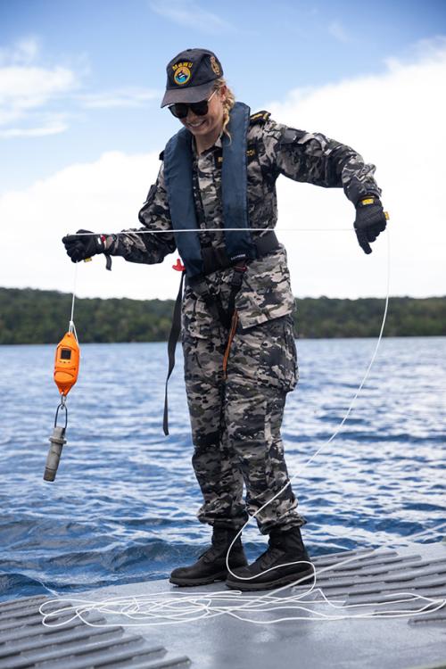
AUVs and USVs are the primary platforms driving the transition from traditional, crewed survey platforms to a distributed and agile hydrographic capability. It is predicated on the maturation of two key technological streams: autonomous maritime systems for data acquisition and artificial intelligence for data processing and analysis. Their principal advantages are persistence and endurance; freed from the constraints of crew fatigue, they can operate for extended periods, from days to months, collecting vast datasets over wide areas. This makes them ideal for tasks such as seafloor mapping, environmental monitoring, and infrastructure inspection.71 Critically, they can be deployed into hazardous or contested environments—such as under polar ice or within denied littoral zones—without placing personnel at risk, a key consideration for military operations.72 Equipped with a suite of high-resolution sensors like multibeam echosounders and side-scan sonars, these platforms can acquire hydrographic data of a quality and density that often surpasses that of surface vessels, particularly in deep water.73
However, their operational utility is constrained by significant limitations inherent to the maritime environment. Finite power endurance remains a primary challenge, with battery life dictating mission duration. Furthermore, the physics of the underwater domain severely restricts communication: radio waves do not penetrate water effectively, forcing AUVs to rely on low-bandwidth, high-latency acoustic communication or to surface to establish satellite links, complicating real-time command and control.74 Consequently, navigation in GPS-denied underwater environments depends on dead reckoning, aided by systems like Inertial Navigation Systems (INS) and Doppler Velocity Logs (DVL), which accumulate positional errors over time.75 Further, satellite based sensor systems, and laser airborne depth sounding systems76 have limitations due to the depth of penetration resulting from the ‘hard’ physics which rapidly attenuate electromagnetic waves when penetrating water.
The proliferation of autonomous survey platforms creates a secondary challenge: a data deluge. It may be relatively easy for a small team to deploy many autonomous platforms, which exponentially increases the data collected with the concurrent need for storage, analysis and quality control. A single autonomous system can generate terabytes of raw sonar data in one mission, creating a volume of information that is difficult to process and analyse efficiently through manual, human-centric methods. This is where AI and ML become critical enablers.77 AI-powered algorithms are being developed to automate many of the most time-consuming aspects of the hydrographic workflow. This includes data cleaning—using ML models to automatically detect and remove ‘noise’ and anomalies from bathymetric datasets—and feature extraction, where algorithms can be trained to identify and classify specific seabed features, such as rock, sand, vegetation, or man-made objects like shipwrecks and pipelines.78 The application of these ‘GeoAI’79 techniques promises to dramatically compress the timeline from data acquisition to the generation of actionable intelligence, a key requirement for military hydrography.80
However, this reliance on AI introduces new vulnerabilities, most notably the risk of ‘data poisoning’, where an adversary could deliberately corrupt the training data used to build an ML model, causing it to misclassify features or fail at critical moments.81 This, along with broader ethical considerations,82 underscores the imperative of maintaining ‘meaningful human control’ over autonomous systems and subsequent processing of data: that is, ensuring that human judgement remains central to the decision as to where an AUV may be deployed and able to rely on the data collected. It warrants note that such considerations are different from those raised in relation to autonomous systems that can exert lethal force (e.g. a lethal autonomous weapon system (LAWS)): for such weapons systems, one might ethically expect greater human involvement in decision-making before and during deployment.83 Further discussion of LAWS is beyond the scope of this thesis, even though it is not inconceivable that future autonomous hydrographic data collection platforms may also have lethal capabilities.
Underpinning this entire technological ecosystem is the International Hydrographic Organisation’s (IHO) S-100 Universal Hydrographic Data Model.84 S-100 is a framework designed to replace the legacy S-57 standard, which was too rigid to support the dynamic, data-rich environment of modern navigation.85 S-100 is not a single product but a framework that allows for multiple, interoperable data layers to be used simultaneously. This enables a user to overlay a base S-101 Electronic Navigational Chart (ENC) with dynamic, near-real-time information such as S-102 high-resolution bathymetry, S-104 water levels, and S-111 surface currents, all within a single system.86 Crucially, the S-100 framework is designed to be machine-readable and plug-and-play, making it the foundational digital architecture for the future of navigation. Its ability to standardise and integrate diverse hydrographic and oceanographic data streams is a fundamental enabler for both autonomous maritime systems and the AI-driven applications that process their data, effectively heralding a future of smarter and safer seas.87 A warfighter with such data, and the ability to use such data will be at a tactical advantage compared to those without. Data that is analysed becomes ‘intelligence’,88 intelligence which is relevant and can be readily used by warfighters creates a tactical, and in some cases, strategic advantage.
Chapter 4: Integrating Autonomy: A Comparative Analysis of RAN and Allied Experiences
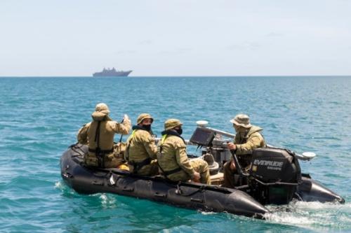
The strategic and technological imperatives set out in the preceding chapters are driving a fundamental shift in how navies conduct hydrographic (and mine countermeasures (MCM)) operations. Accordingly, this transition from crewed platforms to autonomous systems is not unique to the RAN but is now a common challenge faced by its closest allies. This chapter examines the RA’s nascent efforts to integrate autonomy, focusing on its key operational units and acquisition projects (e.g., the Deployable Geospatial Support Teams (DGSTs) initiative) and relevant acquisition projects (e.g., SEA 1770)). It then provides a comparative analysis of the approaches being taken by the RN and the USN, drawing out pertinent lessons that can inform the RAN’s own workforce transformation. The RAN’s practical integration of autonomous systems is spearheaded by its DGSTs. These small, agile teams are designed for rapid deployment into operational areas to conduct a ‘rapid environmental assessment’ (REA)89, a capability crucial for amphibious operations and disaster relief.90 During humanitarian assistance operations in Tonga and multinational exercises like RIMPAC, DGSTs have demonstrated their ability to use portable systems, such as inflatable boats equipped with multi-beam echo sounders, to survey beach approaches and landing zones, ensuring safe access for larger assets.91
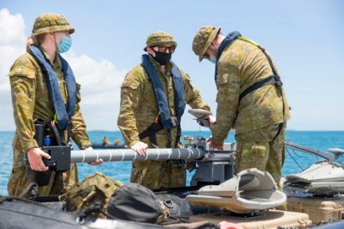
It warrants note that this operational concept was formalised and equipped through acquisition programs like SEA 1770, which delivered a suite of REA tools including REMUS 100 Autonomous Underwater Vehicles and purpose-built Survey Craft.94
The RN is pursuing a remarkably similar trajectory. Under its Mine Countermeasures and Hydrographic Capability (MHC) program, the RN is also divesting from traditional survey ships like HMS Echo and Enterprise.95 In their place, the newly established Hydrographic Exploitation Group (HXG) operates as a specialised unit focused on deployable hydrography. Like the RAN’s DGSTs, the HXG uses a combination of small survey boats (Vahana-class), AUVs, and other ‘flyaway’ kits to conduct rapid surveys. This transformation, driven by Project HECLA, is designed to make hydrographic support more agile and responsive.96 The key lesson from the RN’s experience is organizational: the decision to separate the hydrographic and meteorological specialisations into two distinct units (the HXG and the Metoc Information Warfare Group) suggests that developing deep expertise in autonomous systems requires a dedicated and focused organisational structure.97 It is noteworthy that the RAN never did amalgamate in a way that required the meteorological and hydrographic categories to be cross-trained. In the RAN both categories gather and analyse different types of maritime geospatial intelligence (i.e. one hydrographic, one meteorological) requiring vastly different training, although they are led and administered together.
The US Navy, while also heavily investing in uncrewed systems, offers a different model of integration, not so much for its hydrographic systems, but its MCM capabilities. Rather than a platform-agnostic, deployable toolkit (which the RAN has for hydrographic, and will likely pursue for MCM), the USN’s primary MCM capability is being integrated into a specific platform: the Littoral Combat Ship (LCS) Mine Countermeasures Mission Package (MP).98 This package employs a suite of uncrewed systems, including the Mine Countermeasures Unmanned Surface Vehicle (MCM USV), which acts as a mothership for both the Unmanned Influence Sweep System (UISS) for detonating mines and the AN/AQS-20 sonar for minehunting.99 At this juncture, it is important to understand that the technologies in use for MCM, particularly the ‘detection phase’ is fundamentally the same as hydrographic surveying technologies. It is simply the case that the ‘risk’ they are seeking to mitigate against is of a different nature. The UISS and AN/AQS-20 sonar is complemented by the Knifefish, a heavyweight AUV designed to detect buried and high-clutter mines.100 The USN’s experience provides a cautionary lesson in the complexities of systems integration. While highly capable, the LCS MCM MP has faced significant delays and challenges during operational testing, highlighting the difficulty of fielding a reliable ‘system of systems’.101 The overarching direction is managed by the Naval Meteorology and Oceanography Command (CNMOC), which sources data from a vast array of uncrewed platforms to provide environmental awareness.102
For the RAN, the experiences of its allies validate its strategic direction while offering crucial insights. The parallel evolution of the RN’s HXG confirms the operational logic of creating specialised, deployable teams. The RN’s size and hydrographic capability is also more akin in size to the RAN’s hydrographic capability. By contrast, the USN’s size vastly outweighs both the RN and RAN. Consequently, the USN is able to continue to operate platforms that are specialized, thus introducing the complexity of ‘systems in systems’103 issues. The USN’s journey with the LCS MCM package underscores the immense technical and programmatic challenges of integrating multiple complex autonomous systems, reinforcing the value of the RAN’s more incremental, ‘evergreening’ approach outlined in its RAS-AI Campaign Plan.104 Ultimately, the success for all three navies hinges on interoperability. The AUKUS Pillar 2 framework, with its focus on undersea capabilities and autonomy, provides the critical mechanism for this collaboration.105 Joint exercises, such as the Maritime Big Play series, are essential for developing the common data standards and operating procedures needed to ensure that the autonomous systems of all three nations can operate as a cohesive force, turning technological potential into a collective strategic advantage.106 Although beyond this thesis’s scope, beneficial insights can also be gained from further research that engages in a comparative analysis of the hydrographic capabilities of India, France and Canada.107
Chapter 5: Workforce Transformation for an Autonomous Future: The Core Analysis
The preceding chapters established the strategic and technological imperatives driving the modernisation of the RAN’s hydrographic capability. The strategic context of the Indo-Pacific, mandates a shift towards a 'strategy of denial' enabled by disruptive technologies, while the maturation of autonomous systems and AI offers the means to achieve this.108 This chapter forms the core of the thesis, directly addressing the central research question by arguing that the successful integration of these technologies is contingent not on procurement alone, but on a profound and deliberate workforce transformation. It moves from the ‘what’ (technology) and ‘why’ (strategy) to the ‘who’ and ‘how’ of the human dimension, dissecting the multifaceted nature of this evolution—from individual skills and professional identity to the organisational culture required to field a truly hybrid human-machine force.
The Evolving Identity of the Hydrographic Specialist: From Mariner to Systems Operator
The fundamental identity of the naval hydrographic specialist is undergoing a paradigm shift. The traditional role, rooted in seamanship and the meticulous, hands-on survey work conducted from the decks of dedicated platforms like the now-decommissioned Leeuwin and Paluma classes, is becoming obsolete.109 The future specialist is a technologist first: a multi-domain systems operator, data scientist, and AI interpreter whose value is defined by their ability to manage a distributed network of autonomous assets, rather than (necessarily) a deep proficiency in the full range of traditional mariner skills.110 This conceptual evolution is driven by tangible capability decisions. The divestment of platform-centric assets and the move towards deployable, containerised ‘tool-kits’ under projects such as SEA 1770 and the now cancelled SEA 1905 physically severs the surveyor from a specific ship, necessitating a new identity founded on the capability they wield, not the vessel they serve in.111
This transition is not unique to the RAN. The Royal Navy’s parallel shift away from traditional survey ships in favour of the deployable, autonomous-equipped Hydrographic Exploitation Group validates this conceptual model, demonstrating an allied move towards a capability-centric workforce.112 The RAN itself signals this change in its recruitment material, which now highlights the ‘adoption and delivery of leading edge Geospatial Autonomous systems’ as a rewarding and central aspect of the role.113 This shift, however, fundamentally alters the social contract between the Navy and its sailors. Historically, a sailor's career progression was intrinsically linked to accumulating sea time on commissioned hydrographic ships, which are specialised warships. The new model, exemplified by the Deployable Geospatial Support Teams operating from shore or vessels of opportunity, disrupts this pathway.114 A hydrographic specialist may now accumulate less ‘traditional’ sea time, potentially disadvantaging them under legacy sea-time accrued pay allowance models. This creates a critical challenge for Navy's personnel management: it must redefine what constitutes valuable operational experience. Is it days at sea, or can it be the successful execution of a complex autonomous survey mission from a shore-based control centre? Failure to adapt these cultural and policy frameworks risks devaluing the very personnel who are essential to the future fight.
Building the New Workforce: Skillsets, Training, and Career Pathways
To generate this future workforce, the RAN must fundamentally adapt its approach to training, recruitment, and retention. The required competencies extend far beyond traditional hydrography into domains of robotics, data science, AI and machine learning, and systems engineering.115 Personnel must be skilled not only in operating autonomous vehicles but also in managing the vast datasets they produce, critically evaluating AI-driven analysis, and understanding the systems engineering principles of complex, software-intensive platforms.116 This necessitates a training and education pipeline that prioritises advanced technical acumen. The RAN must deepen its partnerships with institutions like the Australian Maritime College and establish clear pathways for its personnel to attain postgraduate qualifications.117
Recruiting and retaining this talent presents a formidable challenge. The ADF is already facing significant recruitment shortfalls in a competitive labour market, particularly for skilled individuals.118 The skills required for an autonomy-enabled hydrographic workforce are precisely those in high demand by the civilian technology sector, which can offer more lucrative compensation. While the introduction of a continuation bonus scheme is a positive step, a generic financial incentive may be insufficient to retain highly specialised personnel.119 The career pathway itself must be compelling, offering unique operational experiences, continuous professional development, and a clear trajectory to appropriate leadership positions that industry cannot replicate. The profound nature of this skills transformation is best illustrated through a direct comparison of the legacy and future roles, as detailed in Table 5.1.
| Characteristic | Legacy Capability (Platform-Centric) | Future Capability (Autonomy-Enabled) |
|---|---|---|
| Primary Tasks | Manual data collection; ship navigation; direct sensor operation. | Mission planning for AUVs/USVs; remote system supervision; AI-assisted data validation. |
| Core Technical Skills | Seamanship; traditional survey techniques; celestial navigation. | Robotics operation; network management; data science; AI/Machine Learning (ML) interpretation; systems engineering. |
| Cognitive Skills | Methodical data recording; procedural compliance. | Complex problem-solving; interpretation of AI outputs; dynamic mission re-tasking. |
| Operating Environment | Aboard commissioned survey vessel (e.g., Leeuwin-class), mixed with shore based camps for ‘tidal data collection’. | Deployable teams; shore-based control centres; vessels of opportunity. |
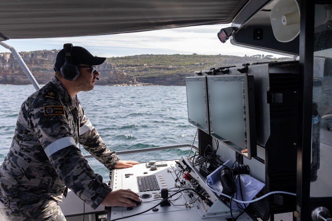
| Primary Human-Machine Interface | Ship's helm; single-beam or multi-beam echosounder, and sidescan sonar console. | Autonomous system control console; AI-driven data analysis software; collaborative mission planners. |
Human-Machine Teaming in the Littoral: A New Operational Paradigm
The effective employment of these new systems operationalises the concept of Human-Machine Teaming (HMT) in the hydrographic context. HMT is more than a technological interface; it represents a new way of working that demands new tactics, techniques, and procedures (TTPs), robust models of trust, and a redefinition of the human’s role as a supervisor and mission commander (and ‘troubleshooter’), rather than a direct operator. As an offset strategy, HMT aims to improve sensing, analysis, and decision-making while removing personnel from harm's way (or when not in a conflict area, at least away from the elements)—a direct alignment with the DSR’s strategic imperatives.120 The RAN’s RAS-AI Campaign Plan 2025 explicitly identifies increasing the understanding of HMT as a key line of effort.121
This paradigm shift presents significant human factors challenges. Operators must build calibrated trust in the reliability of autonomous systems and the validity of their AI-generated outputs, maintain situational awareness while physically removed from the sensors, and manage the cognitive load of supervising multiple complex systems simultaneously.122 This requires a new ‘language’ of command and control. Traditional naval command is hierarchical and direct. An operator cannot manually pilot multiple AUVs simultaneously; therefore, the interaction must evolve from direct control (e.g., ordering ‘steer 10 degrees to port’) to mission-based command (e.g., ‘survey this area, avoid these threat zones, maintain this data quality, and report anomalies’).123 This requires the human operator to develop a deep, intuitive understanding of the AI’s decision-making logic, its capabilities, and its limitations. This is the essence of ‘teaming,’ and it necessitates a new training focus: teaching personnel how to team with an AI, a cognitive and psychological skill that transcends mere technical operation.
Organisational and Cultural Adaptation for a Hybrid Force
Ultimately, the full potential of an autonomy-enabled hydrographic capability cannot be realised within the RAN’s existing organisational and cultural constructs. While the Navy has laudably articulated a need to foster a culture of innovation and agility, large military organisations are often inherently resistant to disruptive change.124 The experience of allied navies shows that successful technology integration requires evolving acquisition strategies and a willingness to challenge established processes; systems that are not deemed ‘fit for purpose’ by the end-user will face resistance, undermining trust and hindering adoption.125 The creation of specialised units, such as the RN's HXG or the RAN's own Maritime Deployable Robotic and Autonomous Systems Experimentation Unit, is a logical step, suggesting that deep expertise may need to be nurtured in focused cells before being integrated more broadly.126
Although not mutually exclusive, this technological shift risks creating a cultural rift between the traditional ‘warrior’ class, whose careers are defined by operational command at sea, and a new ‘technologist’ class, whose expertise is analytical and systems-based. If these new specialists are perceived merely as a ‘support’ function, their influence on operational planning may be limited, and the Navy will struggle to retain them. This presents a critical leadership challenge that extends beyond the hydrographic community. Senior leadership must actively champion the value of these new specialists by creating viable career pathways to senior ranks (perhaps broadening their experience beyond hydrography), integrating them fully into operational planning, and fostering a culture where data-driven insights from an AI-enabled team are valued as highly as a commander’s intuition. At the higher ranks individuals will have strengths not necessarily leveraged off at the tactical level, such as strategic insight and empathy. These too should be fostered, and talent identified early, particularly for officers. Failure to bridge this cultural divide risks creating a two-tiered workforce and devaluing the very skills the Navy needs to maintain its edge in future conflicts.
The transformation of the hydrographic workforce is a complex, multi-layered challenge that extends far beyond simple retraining. It demands a fundamental rethinking of professional identity, the creation of new career models to compete for talent, the development of novel operational concepts for HMT, and a deliberate, leader-led cultural adaptation. Successfully navigating this transformation is not merely a prerequisite for a modern hydrographic capability; it is a microcosm of the challenge facing the entire RAN as it seeks to become a truly capable, AI-enabled future force.
Chapter 6: The Supporting Ecosystem: Industry, Research, and Innovation
The profound workforce transformation detailed in the preceding chapter does not occur in a vacuum. It is both a response to and a dependency of a broader national (and international) ecosystem comprising industry partners, dedicated research and development (R&D) entities, and new innovation accelerators. The RAN’s ability to generate and sustain a future hydrographic workforce is inextricably linked to the health, agility, and collaborative capacity of this ecosystem. This chapter assesses the key components of this supporting structure, evaluating the strategic role of industry partnerships, the contributions of the national research base, and the potential of new mechanisms designed to accelerate capability delivery. It argues that while Australia possesses significant strengths in this ecosystem, realising the full potential of an autonomous hydrographic capability requires a deliberate and integrated approach to harnessing these national assets.
The Strategic Shift to Industry Partnership: HIPP as a Catalyst
A central pillar of the RAN’s evolving hydrographic capability model is the strategic decision to partner more closely with the commercial sector, a policy embodied by the HydroScheme Industry Partnership Program. As demonstrated in Chapter 1, HIPP outsources a significant portion of Australia’s national charting responsibility to a panel of specialist hydrographic survey companies.127 This represents a fundamental restructuring of the national hydrographic enterprise, driven by a clear strategic logic. By leveraging the capacity and innovation of the commercial sector to conduct broad-area surveying, the RAN’s uniformed hydrographic workforce can be refocused on its core military function: the provision of specialised military geospatial intelligence (GEOINT) in direct support of operations.128 This aligns closely with the Defence Strategic Review’s recommendation for a more ‘focused force’.129
This partnership model is a significant strength, stimulating the growth of a sovereign Australian hydrographic industry and encouraging the adoption of new technologies, including the use of AUVs and USVs for nautical charting surveys.130 However, it also introduces a critical weakness and a long-term strategic risk. An over-reliance on industry for foundational survey tasks risks the atrophy of core military hydrographic skills within the permanent naval force. This creates a potential capability dependency, where the RAN might lose the organic ability to conduct large-scale or complex survey operations without commercial support. It could be argued that even without HIPP military hydrographic skills and experience was already atrophying due to tasking hydrographic surveying platforms with other unrelated high priority taskings such as border protection. The conduct of rapid environmental assessment (REA) military surveys is assisted when the ‘operators’ (i.e. the hydrographic surveyors) have a great deal of experience in surveying generally. Furthermore, the HIPP model places immense pressure on Defence’s ability to act as an ‘intelligent customer’—requiring a workforce skilled not just in surveying, but in complex contract management, quality assurance, and the verification of industry-provided data. The challenge for the RAN (and more directly, the Australian Geospatial Intelligence Organisation (AGO) to which the AHO is a part)131, therefore, is to strike a delicate balance: leveraging industry’s strengths without sacrificing the sovereign military expertise that is indispensable in a contested environment.
The National Research and Development Engine
Underpinning the technological advancement of the hydrographic capability is a national R&D ecosystem composed of government, academic, and collaborative research entities. At its core is the Defence Science and Technology Group (DSTG), the Australian government’s lead agency for applying science and technology to national security.132 DSTG provides impartial scientific advice and works closely with AGO, the RAN, industry, and academia to deliver capability enhancements, playing a key role in shaping and executing the RAS-AI Campaign Plan.133 Its deep expertise in areas such as sonar technology, data processing, and systems integration provides the essential scientific foundation for acquiring and fielding complex autonomous systems.134 Importantly it keeps abreast of international technological developments, both in industry generally and militaries.
Complementing DSTG is the Trusted Autonomous Systems Defence Cooperative Research Centre (TAS DCRC), a unique entity established to foster collaboration between industry, research organisations, and Defence.135 TAS DCRC’s focus is not just on autonomy, but on trusted autonomy, addressing the critical HMT challenges central to the workforce transformation.136 Its work on developing assurance methodologies and supporting the creation of regulatory frameworks, such as the Australian Code of Practice for Autonomous and Remotely Operated Vessels, is a vital enabler for the safe and effective operationalisation of these new technologies.137 The opportunity presented by this R&D landscape is the potential to create a virtuous cycle: Defence defines the operational problems, DSTG and TAS DCRC facilitate the collaborative research to solve them, and industry partners commercialise and deliver the solutions.
Accelerating Innovation: From Concept to Capability
A persistent weakness in Australia’s defence innovation ecosystem has been the difficulty in transitioning promising technologies from the laboratory into the hands of the warfighter—a challenge often referred to as the ‘valley of death’.138 The establishment of the Advanced Strategic Capabilities Accelerator (ASCA) is a direct response to this systemic problem, created to fast-track the development and acquisition of disruptive capabilities.139 With a mission-oriented approach and a mandate to move with speed and agility, ASCA represents a significant opportunity to overcome the institutional inertia that can stifle innovation.140
ASCA’s relevance to hydrographic modernisation is already evident. Its inaugural ‘Mission Zero’ is the Ghost Shark program,141 which delivers three extra-large autonomous undersea vehicles (XL-AUVs), a clear investment in the future of maritime autonomy (although from publicly available information it is not clear they can collect hydrographic data).142 Furthermore, ASCA is actively leveraging the AUKUS Pillar 2 framework through initiatives like the Maritime Innovation Challenge, which focuses on undersea communications and the control of autonomous systems.143 This mechanism provides a powerful pathway to not only accelerate sovereign capability but also to ensure deep interoperability with key allies. The primary threat to this model is structural/cultural. The success of ASCA will depend on its ability to challenge Defence’s traditional risk-averse culture and streamline cumbersome procurement processes, which have historically been barriers to rapid innovation.144
In synthesis, the ecosystem supporting the RAN’s hydrographic modernisation is characterised by significant strengths and opportunities. It possesses a growing and increasingly capable domestic industry, a robust government-led R&D base, and new, agile mechanisms designed to accelerate innovation. However, it is also beset by weaknesses and threats, including the risk of eroding sovereign military skills through over-reliance on industry, a historically risk-averse institutional culture, and the immense pressure of a deteriorating strategic environment that demands capability delivery at an unprecedented pace. For the transformed hydrographic workforce, this ecosystem is the professional environment in which it must operate. Its ability to effectively partner with industry, collaborate with researchers, and leverage new innovation pathways will be the ultimate determinant of whether the promise of an autonomous future can be translated into a decisive capability edge for the RAN.
Chapter 7: Policy, Doctrine, and Regulatory Alignment: Supporting the Transformation
The successful transformation of the Royal Australian Navy’s hydrographic workforce, as analysed in the previous chapters, is not solely dependent on acquiring new technologies or developing new skillsets. It requires an equally profound evolution in the ‘soft infrastructure’ that governs naval operations: the policies, doctrine, and legal frameworks that provide the authority, guidance, and constraints for the employment of an autonomy-enabled capability. The strategic direction in the NDS and the technological potential of Robotics, Autonomous Systems, and Artificial Intelligence create a powerful momentum for change.145 However, this momentum risks being stalled by legacy doctrinal concepts and a regulatory environment designed for an era of exclusively human-crewed vessels. This chapter evaluates the alignment of the RAN’s existing policy and doctrine with the demands of its future hydrographic force and examines the significant challenges posed by the national and international legal landscape, arguing that without deliberate reform in these areas, the full potential of the transformed workforce and its advanced capabilities cannot be realised.
Aligning Naval Doctrine with a Transformed Capability
The RAN has demonstrated strategic foresight in its high-level policy documents, most notably the RAS-AI Strategy 2040 and its supporting RAS-AI Campaign Plan 2025.146 These documents articulate a clear vision for leveraging autonomous systems to enhance combat power, increase mass, and reduce risk to personnel, directly aligning with the DSR’s ‘Strategy of Denial’.147 The Campaign Plan explicitly identifies the workforce as a key line of effort, acknowledging the need for new training paradigms and a deeper understanding of HMT.148 This represents a crucial top-down endorsement of the workforce transformation at the heart of this thesis.
However, a gap persists between this high-level strategic vision and the development of detailed operational doctrine. The transition from a platform-centric to a capability-centric mindset, exemplified by the divestment of survey ships in favour of deployable ‘tool-kits’ under projects like SEA 1770 and the discontinued SEA 1905, requires a fundamental rewrite of the tactical-level doctrine that guides how hydrographic effects are delivered.149 Traditional maritime doctrine is built around the ship as the primary unit of action. The new model, centred on agile, shore-based or vessel-of-opportunity-deployed teams like the DGSTs, demands new concepts of operation (CONOPS) that are not yet fully mature.150 The experiences of allied navies, particularly the Royal Navy’s establishment of the HXG, provide a valuable template, but the RAN must develop its own doctrine tailored to its specific strategic geography and force structure.151 Without this doctrinal evolution, the transformed workforce will be equipped with revolutionary tools but constrained by evolutionary—or even archaic—rules of employment. The RAN DGSTs are equipped with conventional small boat technologies (e.g., multi-beam echo-sounders, and side-scan sonars) rather than AUV and RAS systems, with the exception of a small number of REMUS 100S AUVs that are being used to ‘explore’ the possibilities of such technology.
Navigating the National Regulatory Maze (other than warships/Defence vessels)
A significant handbrake on the operationalisation of autonomous maritime systems (particularly in the civilian sector)152 is the national and international legal framework, which was conceived entirely for crewed vessels. In Australia, the primary legislative instruments are the Navigation Act 2012 and the Marine Safety (Domestic Commercial Vessel) National Law Act 2012.153 A fundamental challenge arises from the core definitions within these Acts. The definition of a ‘vessel’ is tied to its use in ‘navigation,’ a term traditionally interpreted as involving planned movement directed by a human navigator.154 While a remotely operated vehicle with a human ‘in the loop’ may meet this definition, the status of a fully autonomous vessel operating on its own artificial intelligence is legally ambiguous.155
This ambiguity extends to the concepts of ‘master’ and ‘crew.’ Both Acts define the master as the person with ‘command or charge of the vessel’.156 It may be difficult to argue that a remote operator, potentially thousands of kilometres away, or a software programmer/operator who set the mission parameters weeks earlier, has command and charge in the traditional sense.157 Similarly, the definition of a ‘seafarer’ implies a person working ‘on board a vessel’.158 These definitional challenges are not merely academic; they have profound implications for assigning legal responsibility, liability, and accountability in the event of a marine incident. The Australian Maritime Safety Authority (AMSA) has adopted a pragmatic, risk-based policy to navigate these issues, using flexibility mechanisms like exemptions to allow for the operation of uncrewed systems.159 However, this approach is a temporary solution to a systemic problem. Arguably, the law has not kept pace with technology, creating a ‘clunky’ and burdensome regulatory environment that relies on workarounds rather than providing clear, purpose-built guidance for the operators of these new systems.160 I anticipate that such domestic ‘workarounds’ of the law, will become evidence of State practice that will ultimately ‘change’ the international customary law upon which such domestic law is based—but further analysis of this argument however, is beyond the scope of this thesis.
For military (particularly Navy) AUVs and RAS vessels, they could be considered to be ‘warships’, thus exempting them from such domestic legislation and the application of relevant international law.161 Again, such legal detail required to articulate the application of the Work Health and Safety Act 2011 (Cth), is beyond this thesis’s scope; however, the RAN would be required to construct a ‘seaworthiness’ system that meets the legislated work, health and safety requirements for eliminating or at least mitigating risk to the lowest practicable level.162 The Navy is well-versed in such ‘seaworthiness’ practices and application as this is what is pursued for the internal (to Navy) regulation of warships and other Defence vessels currently in operation.
The International Challenge: COLREGs and the Uncrewed Vessel
This regulatory friction is magnified at the international level by the International Regulations for Preventing Collisions at Sea 1972 (COLREGs). These rules are the bedrock of safe navigation globally, but their application to uncrewed vessels is fraught with difficulty.163 The most acute problem lies with Rule 5, which mandates that every vessel shall ‘at all times maintain a proper look-out by sight and hearing as well as by all available means’.164 The long-held interpretation of this rule is that it requires a human lookout. While an autonomous vessel’s sensors may provide a more comprehensive field of view than the human eye, they arguably cannot replicate the human act of ‘hearing,’ nor can they guarantee the infallible, continuous connection required to provide a remote operator with the same level of situational awareness as a person on the bridge.165
Furthermore, the COLREGs are imbued with the concept of ‘good seamanship,’ a standard of prudent action that is qualitative and context-dependent.166 Translating this subjective standard into machine-executable algorithms is a monumental challenge.167 An autonomous system can be programmed with the explicit rules for head-on, crossing, and overtaking situations, but presently struggles with the nuanced, judgement-based decisions that human mariners make in complex traffic scenarios. This legal and practical impasse creates a significant liability risk, which can be relevant to Navy AUVs, particularly during peacetime.168 In a collision, an uncrewed vessel could be deemed to have violated Rule 5 by default, placing its owner and operator at a distinct disadvantage, regardless of the other vessel’s actions.169 This uncertainty poses a direct threat to the transformed workforce — and even more so to the Commonwealth of Australia — which could be placed in a position of legal jeopardy even if operating systems were to be in full compliance with the training and doctrine.
Ethical Considerations in Autonomy
While the primary role of the RAN’s hydrographic capability is data collection, not the application of force, the platforms it may operate would be inherently dual-use. The same autonomous systems used for seabed mapping could, with different payloads, be used for undersea surveillance (and part of the ‘targeting cycle’) and or the application of kinetic effects.170 Therefore, the broader legal and ethical debate surrounding LAWS provides an essential context for the workforce transformation if such activities were to be contemplated. Australia’s position is that any use of autonomy in weapon systems must comply with international humanitarian law, particularly the principles of distinction, proportionality, and precautions in attack.171 This necessitates a robust legal review of all new weapon systems and, crucially, requires a level of human involvement sufficient to ensure accountability.172
The concept of ‘meaningful human control’ is central to this debate.173 Even if such autonomous systems were not to be dual-purpose weapons, meaningful human control would be directly relevant to any future hydrographic specialist. This would ensure accountability and the quality assurance of data gathered. The future hydrographic operators transition to roles supervising multiple autonomous systems, requires their training and doctrine to equip them to exercise control effectively. They must understand the capabilities and limitations of the AI, recognise when to trust its outputs, and know when and how to intervene. This is the essence of effective HMT.174 The ethical obligation to ensure human accountability for the actions of a machine cannot be delegated to the machine itself. Therefore, the doctrinal and regulatory frameworks must be designed not only to enable the technology but to empower the human operator, ensuring they remain the responsible and accountable agent at the centre of the system.
The path to a fully realised, autonomy-enabled hydrographic capability is paved with more than just technological and workforce challenges. It requires a concerted effort to modernise the doctrinal, legal, and ethical frameworks that govern maritime operations. The RAN’s strategic policies have set a clear and ambitious direction, but the detailed operational doctrine is still in development. More critically, the national and international legal systems are arguably lagging, creating ambiguity and risk for the very personnel tasked with operating these new systems. For a transformed hydrographic workforce to operate with confidence and effectiveness, they need more than just advanced skills and equipment; they need clear rules, modern laws, and a robust ethical framework that is fit for the autonomous age.
Chapter 8: Conclusion: Navigating the Future
The strategic landscape of the Indo-Pacific, as redefined by the DSR and the NDS, has set the Royal Australian Navy (RAN) on an irreversible course towards a future defined by disruptive technologies.175 The modernisation of the RAN’s hydrographic capability has emerged not as a niche technical upgrade, but should be seen as a foundational enabler for the nation’s maritime strategy of denial. This thesis has confronted the pivotal challenge accompanying this technological change, addressing the core research question: How would the integration of autonomous systems and artificial intelligence (AI) in the Royal Australian Navy's hydrographic capability impact workforce transformation? The central argument, substantiated through the preceding analysis and discussion, is that the introduction of autonomous platforms and AI-driven analytics necessitates a profound and holistic transformation of the RAN’s specialist hydrographic workforce. This transformation is not a simple matter of procurement and retraining; it is a complex, multi-layered challenge that demands a fundamental reimagining of professional identity, skills, career pathways, organisational culture, and the entire ecosystem that supports the capability.
Synthesis of Findings
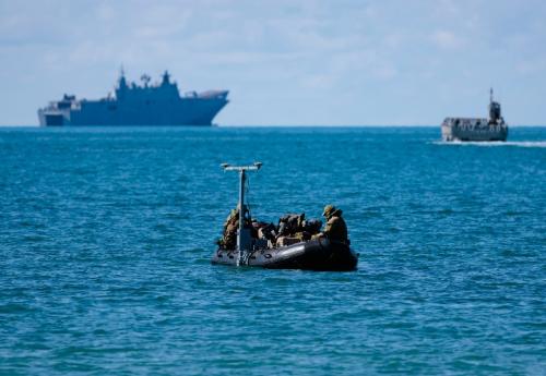
This thesis began by setting out the inescapable strategic context. The DSR’s recommendation for a ‘focused force’ optimised for deterrence in Australia’s northern approaches places a premium on superior environmental knowledge.176 As Chapter 2 argued, the ability to enact denial at sea through effective anti-submarine and anti-surface warfare is impossible without the detailed, timely, and accurate geospatial intelligence that military hydrography provides. The character of modern maritime competition, increasingly conducted in the ‘grey-zone’, further amplifies the need for uncrewed systems that can gather intelligence with persistence and scalability, without the escalatory risk of high-value, crewed platforms.177 This strategic imperative is the primary driver of the modernisation effort.
The technological enablers for this new form of hydrography, as detailed in Chapter 3, are maturing rapidly. The dual streams of RAS for data acquisition and AI for data processing are fundamentally altering the nature of the work. AUVs and USVs offer the ability to operate persistently in hazardous environments, while AI and machine learning are becoming essential tools to manage the resultant ‘data deluge’ and accelerate the timeline from data collection to actionable intelligence.178 This technological shift has catalysed a move away from the legacy, platform-centric model of the Leeuwin and Paluma-class survey ships, as outlined in Chapter 1. The RAN’s current trajectory, validated by the comparative analysis of allied experiences in Chapter 4, is towards a capability-centric model. This model is defined by small, agile, and deployable units like the Deployable Geospatial Support Teams, equipped with a ‘tool-kit’ of systems (yet to be fully optimized with scalable autonomous systems), but a concept remarkably similar to the Royal Navy’s Hydrographic Exploitation Group.179
At the heart of this thesis, Chapter 5 argued that this new capability model is contingent upon a radical workforce transformation. The professional identity of the hydrographic specialist is evolving from that of a mariner, whose expertise was forged at sea, to that of a technologist—a multi-domain systems operator, data scientist, and AI interpreter. This shift creates profound challenges for the RAN’s traditional personnel management structures, which have long equated sea time with operational experience and career progression. The new model demands a workforce with advanced competencies in robotics, data science, and systems engineering, skills that are in high demand across the economy, creating significant recruitment and retention challenges.180 Furthermore, the effective employment of these new systems requires a new operational paradigm of Human-Machine Teaming, demanding new skills in mission-based command, calibrated trust in AI, and the management of cognitive load.181 This, in turn, risks creating a cultural rift between the traditional ‘warrior’ class and this new ‘technologist’ class, a divide that only deliberate, senior-leader-led action can bridge.
This transformation does not occur in isolation. As Chapter 6 assessed, it is dependent on a supporting national ecosystem of industry, research, and innovation. The HydroScheme Industry Partnership Program is a strategic strength, growing sovereign industrial capacity and allowing the uniformed workforce to focus on military-specific tasks.182 However, it also presents a strategic risk: the potential atrophy of core military survey skills if not carefully managed. The national research and development base, including the DSTG and the TAS DCRC, provides the essential engine for innovation, while new mechanisms like the Advanced Strategic Capabilities Accelerator offer a pathway to overcome the traditional ‘valley of death’ in defence procurement.183 Finally, Chapter 7 highlighted the most significant constraint on this entire enterprise: the ‘soft infrastructure’ of policy, doctrine, and regulation. While high-level strategy is aligned, operational doctrine is immature. Further, the national and international legal frameworks, conceived for a world of crewed vessels, are lagging behind the pace of technology, creating legal ambiguity and operational risk.184
Answering the Research Question: A Holistic Transformation
The integration of autonomy and AI impacts the RAN’s hydrographic workforce transformation across its entire structure. Due to the presently low uptake of autonomy in the service, the impacts and challenges are yet to be understood and absorbed. It is a holistic challenge that touches every aspect of the human capability, from the individual sailor to the strategic management of the specialisation. The impact is a fundamental shift from a workforce that operated equipment to one that commands systems; from a culture that valued time at sea to one that must value technical mastery; and from an organisation structured around platforms to one structured around deployable, mission-configurable capabilities. The transformation is therefore not merely technical, but cognitive, cultural, and organisational. Success is not guaranteed by the acquisition of AUVs; it will be determined by the Navy’s ability to cultivate the human talent to employ them effectively.
Recommendations for Navigating the Future
Based on the analysis conducted in this thesis, five high-level, principle-based recommendations are offered to guide the RAN in navigating this complex transformation. These are not prescriptive solutions but strategic lines of effort intended to address the core challenges identified.
- Radically Reform Career Management for Technical Specialists. The RAN must ensure that legacy career models are adapted if ill-suited to a technology-centric workforce. It should design and implement a dedicated career pathway for technical specialists, including hydrographic personnel. This new pathway must value and reward demonstrated technical mastery, the attainment of advanced qualifications in fields like data science and robotics, and successful command of complex autonomous missions. This may involve creating specialist pay scales, offering continuation bonuses tied to specific skills, and establishing clear trajectories to senior leadership for those who excel in the technical domain, ensuring their expertise is retained and integrated at the highest levels of operational planning.185
- Champion a Deliberate, Leader-Led Cultural Shift. Cultural change cannot be delegated; it must be driven from the top. The senior leadership of the RAN must actively and visibly champion the value of the ‘technologist’ class. This requires more than rhetoric; it demands tangible actions. Senior leaders should ensure these specialists are embedded in operational planning staffs, that their data-driven insights are demonstrably valued in decision-making processes, and that their unique operational contributions—whether from a shore-based control centre or a vessel of opportunity—are recognised and celebrated with the same vigour as traditional feats of seamanship. This will be critical to breaking down the cultural friction between the ‘warrior’ and ‘technologist’ and fostering a truly integrated force.186 This is arguably already underway in the information warfare and cyber workforces, so it is not a stretch to apply this across other fields.
- Forge an Integrated and Advanced Training and Education Pipeline. Although the ad-hoc upskilling of personnel might be necessary in the short term to identify and optimize the most appropriate training and training pathways for technologists, it will be insufficient in the medium to long term. The RAN must establish a formal, integrated training and education pipeline that builds the hydrographic specialist of the future from enlistment/appointment to separation. This pipeline should blend foundational naval and mariner skills with a mandatory, career-long stream of advanced technical education. This requires deepening partnerships with academic institutions like the Australian Maritime College and creating funded pathways for personnel to attain postgraduate qualifications in critical fields. Given the civilian hydrographic sector is already grappling with autonomy and AI advances, it is anticipated that the civilian training and standards can be adopted to a large degree. Serious thinking will be required to ensure that the civilian standards remain appropriate to the militarized use of such technologies.
- Lead the Modernisation of Maritime Law and Doctrine. The RAN cannot afford to be a passive observer in the evolution of maritime law. It must proactively influence, both nationally with the Australian Maritime Safety Authority and internationally through the International Hydrographic Organization and International Maritime Organization, the modernization of the regulatory frameworks governing autonomous vessels, particularly the COLREGs. Concurrently, but perhaps more importantly, it must accelerate the development of its own tactical-level doctrine and CONOPS for autonomous hydrographic operations. This requires a dedicated effort, potentially through a specialised experimentation unit, to wargame scenarios, test tactics, techniques and procedures, and rapidly codify the lessons observed into practical doctrine, such that they become lessons learned which empower the workforce to operate with legal and operational clarity.187
- Actively Manage the Sovereign Skill Base. The partnership with industry through HIPP is a strategic asset, but it must be managed with a clear-eyed view of its risks. The RAN must implement a formalised program to ensure its uniformed personnel retain and develop high-end, complex survey skills, particularly those required for contested military operations. The AHO needs to ensure there is a cadre of highly skilled ‘intelligent customers’ capable of sophisticated contract management and data quality assurance. It also requires ensuring that DGSTs and other military teams are regularly assigned complex survey tasks that maintain their proficiency, preventing the atrophy of the sovereign military expertise that remains the ultimate guarantor of the capability in a crisis.188
Limitations and Areas for Future Research
This thesis has been constrained by its reliance on publicly available information, precluding access to classified Defence planning documents that could provide a more granular view of the workforce challenges and current workforce planning. Furthermore, as noted earlier, the analysis represents a snapshot in time in a field characterised by rapid technological and strategic change. Several areas warrant further, dedicated research. A detailed quantitative analysis of the current and projected skill gaps within the hydrographic workforce would provide invaluable data for planners. A longitudinal study of HIPP’s long-term impact on the RAN’s sovereign skill base would be critical to validating or adjusting the current industry partnership model. Finally, a comparative analysis of the workforce transformation strategies of other middle-power navies with advanced hydrographic capabilities, such as those of France or Canada, could yield further valuable insights and lessons for the RAN.
In conclusion, the RAN has correctly identified the strategic and technological necessity of modernising its hydrographic capability, albeit the acquisition project SEA1905 has been cancelled due to other priorities. Regardless, a bold and necessary transformation will be forced upon the hydrographic service, already having moved from the crewed platforms of the past to concentrate on purely military surveying, to leveraging off the autonomous systems of the future. However, this thesis has argued that the ultimate success of this endeavour will not be measured by the sophistication of the machines acquired, but by the Navy’s commitment to transforming the most critical component of its capability: its people. Navigating the complex currents of this change requires more than a new chart; it requires a new kind of mariner—a technologist, a data scientist, and a mission commander, empowered by a supportive culture, a modernised career structure, and a clear policy and, to a lesser extent, legal framework. The future of hydrography is human-machine teaming, and it is only by investing in the human as deliberately as the machine that the RAN will secure the decisive strategic advantage it seeks.
Ablong, Marc. “OPINION | Understanding the cost of Australia's naval defence.” Baird Maritime, 30 May 2025. https://www.bairdmaritime.com/security/naval/opinion-understanding-the-cost-of-australias-naval-defence.
Admiralty, Hydrographic Department. Admiralty Manual of Hydrographic Surveying. Vol. 1. London: Hydrographer of the Navy, 1965.
Advanced Strategic Capabilities Accelerator. “AUKUS Maritime Innovation Challenge 225: undersea communications and autonomy.” https://www.asca.gov.au/current-activities/aukus-maritime-innovation-challenge-2025-undersea-communications-autonomy.
Advanced Strategic Capabilities Accelerator. “Ghost Shark - Mission Zero.” https://www.asca.gov.au/activities/missions/ghost-shark-mission-zero.
AMC Search. “The AMSL Team.” https://www.amcsearch.com.au/amsl-team.
Anderson, David. “Autonomous Ship Laws in Australia.” MLAANZ, May 2018. https://www.mlaanz.org/uploads/1/2/1/3/121322722/autonomous_ship_laws_australia.pdf.
Arthur, Gordon. “Australian defence programmes.” Asian Military Review, 5 June 2025. https://www.asianmilitaryreview.com/2025/06/australian-defence-programmes/.
Asia-Pacific Defence Reporter. “The Advanced Strategic Capabilities Accelerator is up and running to drive defence innovation.” 5 July 2023. https://asiapacificdefencereporter.com/the-advanced-strategic-capabilities-accelerator-is-up-and-running-to-drive-defence-innovation/.
AusSeabed. “Australian's National Hydrographic Surveying has Evolved - HIPP has arrived.” February 2021 Newsletter. https://www.ausseabed.gov.au/data/assets/pdf_file/0005/106934/February_2021_Newsletter22.pdf.
Australian Defence Force Careers. “Hydrographic Surveyor.” https://www.adfcareers.gov.au/jobs/navy/hydrographic-surveyor.
Australian Defence Magazine. “HMAS Melville to be decommissioned.” 22 July 2024. https://www.australiandefence.com.au/news/news/hmas-melville-to-be-decommissioned
Australian Government. “Australia's Submission to the United Nations Secretary-General's Report on Lethal Autonomous Weapons Systems.” Department of Foreign Affairs and Trade, May 2024. https://docs-library.unoda.org/General_Assembly_First_Committee_-Seventy-Ninth_session_(2024)/78-241-Australia-EN.pdf.
Australian Government. 2024-28 Defence Corporate Plan. Canberra: Commonwealth of Australia, 2024. https://previewapi.transparency.gov.au/delivery/assets/80a82ed1-3e33-027b-b7e0-6493f97f18f8/84004b0f-9f70-4bf9-a2d9-3b1e72296630/2024-25%20Department%20of%20Defence%20Corporate%20Plan.pdf.
Australian Government, Department of Defence. 2020 Defence Strategic Update. Canberra: Department of Defence, 2020. https://www.defence.gov.au/about/strategic-planning/2020-defence-strategic-update.
Australian Government, Department of Defence. 2024 National Defence Strategy. Canberra: Department of Defence, 2024. https://www.defence.gov.au/about/strategic-planning/2024-national-defence-strategy-2024-integrated-investment-program.
Australian Government, Department of Defence. Defence Strategic Review. Canberra: Department of Defence, 2023. https://www.defence.gov.au/about/reviews-inquiries/defence-strategic-review.
Australian Government, Federal Register of Legislation. Marine Safety (Domestic Commercial Vessel) National Law Act 2012 (Cth). https://www.legislation.gov.au/C2012A00121/latest/text.
Australian Government, Federal Register of Legislation. Navigation Act 2012 (Cth). https://www.legislation.gov.au/C2012A00128/latest/text.
Australian Government, Federal Register of Legislation. Work Health and Safety Act 2011 (Cth). https://www.legislation.gov.au/C2011A00137/latest/text.
Australian Government, Office of National Intelligence, ‘The Role of Intelligence,’ https://www.oni.gov.au/news/role-intelligence.
Australian Government, National Intelligence Community. “Australian Geospatial-Intelligence Organisation.” https://www.intelligence.gov.au/agencies/ago.
Australian Hydrographic Office. “100 years of hydrography in Defence.” Canberra: Australian Hydrographic Office, 2020. https://www.hydro.gov.au/aboutus/AHO2020/100-years-of-hydrography-in-defence.pdf.
Australian Hydrographic Office. “About Us.” Department of Defence. https://www.hydro.gov.au/aboutus/aboutus.htm.
Australian Hydrographic Office. “Governance.” Department of Defence. https://www.hydro.gov.au/aboutus/governance.htm.
Australian Hydrographic Office. “HydroScheme 2025.” ArcGIS StoryMaps. https://storymaps.arcgis.com/stories/4eebeb4ac3a34f47a7699e63f006ca28.
Australian Hydrographic Office. “HydroScheme Industry Partnership Program.” Department of Defence. https://www.hydro.gov.au/NHP/hipp.htm.
Australian Hydrographic Office. National Report Australia to the 21st Meeting of the SWPHC. Wollongong, NSW: AHO, 2023.
Australian Hydrographic Office. “Our Role.” https://www.hydro.gov.au/aboutus/what.htm.
Australian Hydrographic Office. “Roles and Responsibilities.” Department of Defence. https://www.hydro.gov.au/aboutus/roles.htm.
Australian Hydrographic Office. “What is Hydrography?” https://www.hydro.gov.au/aboutus/what.htm.
Australian Maritime Safety Authority. “AMSA policy on regulatory treatment of uncrewed and/or autonomous vessels.” 20 February 2020. https://www.amsa.gov.au/vessels-operators/domestic-commercial-vessels/amsa-policy-regulatory-treatment-uncrewed-andor.
Australian Maritime Safety Authority. “Autonomous vessels in Australia.” 24 August 2022. https://www.amsa.gov.au/vessels-operators/domestic-commercial-vessels/autonomous-vessels-australia.
Australian National Audit Office. Defence's Implementation of Cultural Reform. Report No. 33 (2020-21). Canberra: ANAO, 2021. https://www.anao.gov.au/work/performance-audit/defence-implementation-cultural-reform.
Australian National Audit Office. Maximising Australian Industry Participation Through Defence Contracting. Audit Report No. 25 2024-25. Canberra: ANAO, 2025. https://www.anao.gov.au/work/performance-audit/maximising-australian-industry-participation-through-defence-contracting.
Australian National Audit Office. Maximising the Value of Australian Industry Participation. Report No. 15 (2022-23). Canberra: ANAO, 2022.
Bachari-Lafteh, Mohammadreza, and Abbas Harati-Mokhtari. “Operator's Skills and Knowledge Requirement in Autonomous Ships Control Centre.” Journal of International Maritime Safety, Environmental Affairs, and Shipping 5, no. 2 (2021): 74-84. https://doi.org/10.1080/25725084.2021.1949842.
Blenkin, Max. “ANAO reports on AIP.” Australian Defence Magazine, 23 May 2025. https://www.australiandefence.com.au/news/news/anao-reports-on-aip.
BlueZone Group. “SEA 1770 Rapid Environmental Assessment.” https://bluezonegroup.com.au/sea-1770-rapid-environmental-assessment/.
Briant, Raphael. “Human Machine Teaming and the Future of Air Operations.” ifri, 23 September 2021. https://www.ifri.org/en/studies/human-machine-teaming-and-future-air-operations.
Centre for Naval Analyses. “Addressing Al's Operational Challenges: Putting the Human in Human-Machine Teaming.” Arlington, VA: CNA, 2021. https://www.cna.org/reports/2021/10/Addressing-Als-Operational-Challenges-Putting-the-Human-in-Human-Machine-Teaming.pdf.
Clague, Angela. “Expanding the Career Track for U.S. Department of the Air Force Officers to Include Technical Specialists.” RAND Corporation, 5 February 2025. https://www.rand.org/pubs/research_reports/RRA2997-1.html.
Coda Octopus. “Seabed Classification.” https://www.codaoctopus.com/other-products/geo/seabed-classification.
Crowe, Ken. “Use of Unmanned Systems by the Australian Defence Force.” Northrop Grumman Australia, 2 January 2015. https://www.aph.gov.au/DocumentStore.ashx?id=7f6210ae-58bd-4f53-a3c9-de159ada93cb&subId=303202.
Davis, Sam, et al. “Innovation Catalyst: ASCA, Accelerating technology development and capability delivery through superior process and reduced barrier partnerships.” Defence Industry Leadership Program Research Paper, November 2023. https://dtc.org.au/files/documents/DILP-Research-Papers/2023/Innovation-Catalyst.pdf.
Defence Connect. “Navy celebrates launch of next-gen survey boat capability.” 9 November 2020. https://www.defenceconnect.com.au/naval/7148-navy-celebrates-launch-of-next-gen-survey-boat-capability.
Defence Science and Technology. DST Capability Portfolio. Canberra: Department of Defence, 2017. https://www.dst.defence.gov.au/sites/default/files/publications/documents/DST%20Capability%20Portfolio_051017.pdf.
Defence Science and Technology Group. “About.” https://www.dst.defence.gov.au/.
Department of Defence. “Equipping the Royal Australian Navy with next generation autonomous undersea vessels.” Media release, 10 September 2025.
Department of Defence. “Hydroscheme industry partnership program commences.” Media release, 26 February 2020. https://www.defence.gov.au/news-events/releases/2020-02-26/hydroscheme-industry-partnership-program-commences.
Defence Annual Report 2023-24. https://www.transparency.gov.au/publications/defence/department-of-defence/department-of-defence-annual-report-2023-24/chapter-2--departmental-overview/nations-combine-on-mine-warfare-activity.
Department of Defence. “Navy team surveys Tonga below the waterline.” Media release, 18 February 2022. https://www.defence.gov.au/news-events/news/2022-02-18/navy-team-surveys-tonga-below-waterline.
Department of Defence. “The establishment of the Advanced Strategic Capabilities Accelerator.” Media release, 1 May 2023. https://www.dst.defence.gov.au/news/2023/05/01/establishment-advanced-strategic-capabilities-accelerator.
Department of Defence. “Working to protect undersea infrastructure.” Media release, 14 February 2025. https://www.defence.gov.au/news-events/news/2025-02-14/working-protect-undersea-infrastructure.
Department of Defence, Defence Science and Technology Group. “Laser Airborne Depth Sounder (LADS).” https://www.dst.defence.gov.au/innovation/laser-airborne-depth-sounder-lads.
Dey, Harshita. “Analysis of Australia's National Defence Strategy 2024.” National Maritime Foundation, 20 May 2024. https://maritimeindia.org/wp-content/uploads/2024/05/Harshita-Dey_Analysis-of-Australias-National-Defence-Strategy-2024-pdf.pdf.
Director General Maritime Development. Leeuwin Class Hydrographic Ship (AGS) HMAS Leeuwin & HMAS Melville, Capability Summary. Canberra: Royal Australian Navy, n.d. https://core.ac.uk/download/268171259.pdf.
Dowse, Andrew. “Australia's Defence Strategy.” Journal of Indo-Pacific Affairs, 10 September 2024. https://media.defense.gov/2024/Sep/10/2003540653/-1/-1/1/JIPA%20-%20SENIOR_LEADER_PERSPECTIVE_DOWSE.PDF.
DTIC. “Challenges of Autonomous Underwater Vehicles in Military Hydrography.” https://apps.dtic.mil/sti/citations/AD1004191.
Editorial Team. “New Al tool to streamline bathymetric data cleansing process.” Safety4Sea, 14 October 2021. https://safety4sea.com/new-al-tool-to-streamline-bathymetric-data-cleansing-process/.
Evergreen Marine (UK) Ltd. v Nautical Challenge LTD [2018] EWCA Civ 2173. https://www.supremecourt.uk/cases/uksc-2018-0216.
Ferl, Anna-Katharina. 2023. “Imagining Meaningful Human Control: Autonomous Weapons and the (De-) Legitimisation of Future Warfare.” Global Society 38 (1): 139–55. doi:10.1080/13600826.2023.2233004.
General Dynamics Mission Systems. “Knifefish Surface Mine Countermeasure UUV.” DASC. https://www.dacis.com/nuxt/programs_sample_record.C2v8zz-.pdf.
George, Melissa. “ADF retention bonus scheme.” Parliament of Australia, 20 June 2023. https://www.aph.gov.au/About_Parliament/Parliamentary_departments/Parliamentary_Library/Research/FlagPost/2023/June/ADF-Retention.
Hains, Denis. “The emergence of Al in hydrography.” Hydro International, 25 February 2021. https://www.hydro-international.com/content/article/the-emergence-of-ai-in-the-hydrography-sector.
Hamden, Mohammad Hanif, and Ami Hassan Md Din. “A review of advancement of hydrographic surveying towards ellipsoidal referenced surveying technique.” IOP Conference Series: Earth and Environmental Science, Volume 169, 9th IGRSM International Conference and Exhibition on Geospatial & Remote Sensing (IGRSM 2018) 24-25 April 2018, Kuala Lumpur, Malaysia. https://iopscience.iop.org/article/10.1088/1755-1315/169/1/012019/pdf.
Ho, Geoffrey, et al. “Human Factors Issues in Unmanned Underwater Vehicles.” Toronto: Defence Research and Development Canada, 2011. https://apps.dtic.mil/sti/tr/pdf/ADA555588.pdf.
Hoehn, Rob. “How the Royal Australian Navy Nurtures Innovators. Innovation Management, 13 July 2020. https://innovationmanagement.se/2020/07/13/how-the-royal-australian-navy-nurtures-innovators/.
Horne, Rachel. “Trusted Autonomous Systems, Defence Cooperative Research Centre Submission to the Independent Review of Domestic Commercial Vessel Safety Legislation.” 30 March 2022. https://www.infrastructure.gov.au/sites/default/files/documents/dcvir-submission-7-trusted-autonomous-systems.pdf.
House of Commons Library. AUKUS pillar 2: Advanced capabilities. Research Briefing CBP-9842. London: UK Parliament, 2 September 2024. https://commonslibrary.parliament.uk/research-briefings/cbp-9842/.
Hydrographic Service RAN. Corporate Overview: Hydrographic Service RAN. Paper presented at the Hydrographic Service RAN Industry Briefing, Wollongong, NSW, 1996. https://apps.dtic.mil/sti/tr/pdf/ADA322159.pdf.
International Hydrographic Organisation. “Major Milestone Achieved in Transition to Smart Navigation with Operational Editions of 5-100 Standards.” 13 January 2025. https://iho.int/en/major-milestone-achieved-in-transition-to-smart-navigation-with-operational-editions-of-s-100-standards.
International Hydrographic Organisation. Standards for Hydrographic Surveys, S-44 Edition 6-1.0. 2020. https://iho.int/uploads/user/pubs/standards/s-44/S-44_Edition_6.1.0.pdf.
International Institute for Strategic Studies. “Australia's 2023 Defence Strategic Review.” Strategic Comments 29, no. 12 (2023). https://www.iiss.org/publications/strategic-comments/2023/australias-2023-defence-strategic-review/.
Jackett, Jennifer. “Defence innovation and the Australian national interest.” Black Swan Strategy Issue 9, June 2023. Perth: Defence & Security Institute, University of Western Australia. https://defenceuwa.com.au/wp-content/uploads/2024/10/Black-Swan-Strategy-Paper-9-Defence-Innovation-and-the-Australian-National-Interest-Jennifer-Jackett.pdf.
Kardon, Isaac B. “Combating the Grey Zone: Examining Chinese Threats to the Maritime Domain.” Carnegie Endowment for International Peace, 4 June 2024. https://carnegieendowment.org/posts/2024/06/combating-the-gray-zone-examining-chinese-threats-to-the-maritime-domain?lang=en.
Kaushal, Sidharth, et al. “Leveraging Human-Machine Teaming: An Offset Strategy Primer and Policy Guide.” Special Competitive Studies Project, January 2024. https://static.rusi.org/human-machine-teaming-sr-jan-2024.pdf.
Keegan, Michael. “Navigating Technological Frontiers in the U.S. Navy.” IBM Center for The Business of Government, 12 June 2024. https://www.businessofgovernment.org/blog/navigating-technological-frontiers-us-navy.
Lancaster, Lily. “Royal Australian Navy Joins Its Army's Landing Force.” DVIDS, 15 July 2022. https://www.dvidshub.net/news/425457/royal-australian-navy-joins-its-armys-landing-force.
Lee, Seojeong, and Hyoseung Kim. “IHO S-100 Data Model and Relevant Product Specification.” TransNav, the International Journal on Marine Navigation and Safety of Sea Transportation 18, no. 2 (June 2024): 297-301. https://www.researchgate.net/publication/377056086_IHO_S-100_Data_Model_and_Relevant_Product_Specification.
Leidos. Rapid Environmental Assessment. Factsheet, Leidos Australia, September 2019. https://www.leidos.com/sites/leidos/files/2019-09/FS-Rapid-Environmental-Survey.pdf.
Leidos Australia. “Leidos Australia To Deliver Key Milestone For SEA1770.” PR Newswire, 8 October 2019. https://enmobile.prnasia.com/releases/global/leidos-australia-to-deliver-key-milestone-for-sea1770-259877.shtml.
“Leidos Australia to Deliver Survey Craft for SEA1770.” Offshore Energy, 8 October 2019. https://www.offshore-energy.biz/leidos-australia-to-deliver-survey-craft-for-sea1770/.
Lemon, Nick. “Autonomous shipping from a regulatory perspective.” IALA. https://www.iala-aism.org/content/uploads/2018/01/12.00-Nick-Lemon-Autonomous-shipping-from-a-regulatory-perspective.pdf.
Liivoja, Rain, and Valjatage, Ann. (eds.) “Autonomous Cyber Capabilities under International Law.” 2021, NATO Cooperative Cyber Defence Centre of Excellence.
Marinac, Anthony. “Two Minute Case Notes, Shaw Savill & Albion (Negligence under another duty).” YouTube video, 1:59. https://www.youtube.com/watch?v=7FrDR8ef5XU.
Margat, Paul, and Michael Staderman. “The Application of COLREGs by Autonomous and Unmanned Vessels: Issues Raised by Situational Awareness, Night-Time Navigation and Good Seamanship.” Institute for the Protection of Maritime Infrastructures, German Aerospace Centre. https://elib.dlr.de/209985/1/MARESEC%202024_paper_12.pdf.
Minister for Defence. “Investing in Defence's people.” Media release, 5 November 2024. https://www.minister.defence.gov.au/media-releases/2024-11-05/investing-defences-people.
Moriarty, Greg. “National Defence Strategy.” Speech, Air and Space Power Conference, Canberra, May 2024. https://airpower.airforce.gov.au/sites/default/files/2024-05/Air%20and%20Space%20Power%20Conference%202024%20Transcript%20Mr%20Greg%20Moriarty%20National%20Defence%20Strategy.pdf.
Nally, Jonathan. “Navy now has only one hydrographic survey ship.” Spatial Source, 12 August 2024. https://www.spatialsource.com.au/navy-now-has-only-one-hydrographic-survey-ship/.
Naval Historical Society of Australia. “HMA Ships Paluma and Mermaid decommissioned.” Call The Hands: NHSA Newsletter, no. 58 (November 2021): 4. https://nhsa-cth.s3.ap-southeast-2.amazonaws.com/Call+The+Hands_NHSA+Newsletter_Issue+58_Nov+21.docx.pdf.
Naval Meteorology and Oceanography Command. “Naval Oceanographic Office.” https://www.cnmoc.usff.navy.mil/navoceano/.
Navy History. “A Brief History of the Australian Hydrographic Service.” Royal Australian Navy. https://navyhistory.au/a-brief-history-of-the-australian-hydrographic-service/.
Navy Lookout. “Royal Navy launches new Hydrographic Exploitation Group to transform survey operations.” 4 June 2025. https://www.navylookout.com/royal-navy-launches-new-hydrographic-exploitation-group-to-transform-survey-operations/.
Neelam, Ryan. “Defence and security.” Lowy Institute Poll 2025 Report, 16 June 2025. https://poll.lowyinstitute.org/report/2025/defence-and-security/.
NOAA Ocean Exploration. “Uncrewed Surface Vessels.” https://oceanexplorer.noaa.gov/technology/usv/usv.html.
Northrop Grumman. “Distributed Autonomy/Responsive Control - DA/RC.” https://www.northropgrumman.com/what-we-do/mission-solutions/distributed-autonomy-responsive-control-da-rc.
Parliament of Australia. “Chapter 5 - Artificial Intelligence and Autonomous Weapons related issues.” https://www.aph.gov.au/Parliamentary_Business/Committees/Joint/Foreign_Affairs_Defence_and_Trade/DefenceAR2022-23/Inquiry_into_the_Defence_Annual_Report_2022-23/Chapter_5-Artificial_Intelligence_and_Autonomous_Weapons_related_issues.
Pfau, Andrew. “Preparing Sailors for the Age of Al.” US Naval Institute, Proceedings 148, no. 4 (April 2022). https://www.usni.org/magazines/proceedings/2022/april/preparing-sailors-age-ai.
Prospects. “Hydrographic surveyor: Job profile.” https://www.prospects.ac.uk/job-profiles/hydrographic-surveyor.
Robertson, Anthony. “What is grey-zone confrontation and why is it important?” The Cove, 18 July 2022. https://cove.army.gov.au/article/what-grey-zone-confrontation-and-why-it-important.
Roche, Philip. “The Collision Regulations and Autonomous Shipping.” Norton Rose Fulbright. https://www.nortonrosefulbright.com/en/knowledge/publications/5fedab67/the-collision-regulations-and-autonomous-shipping.
Royal Australian Navy. “HMAS Leeuwin (II).” https://www.navy.gov.au/capabilities/ships-boats-and-submarines/hmas-leeuwin.
Royal Australian Navy. “HMAS Paluma (IV).” https://seapower.navy.gov.au/history/units/hmas-paluma-iv.
Royal Australian Navy. “Mission & Values.” https://www.navy.gov.au/about-navy/mission-values.
Royal Australian Navy. RAS-AI Campaign Plan 2025. Canberra: Department of Defence, 2024. https://www.navy.gov.au/sites/default/files/2024-02/RAS-AI-Campaign-Plan-2025.pdf.
Royal Australian Navy. Robotics, Autonomous Systems & Artificial Intelligence (RAS-AI) Strategy 2040. Canberra: Department of Defence, 2020.https://www.navy.gov.au/sites/default/files/2024-02/RAS-AI-Strategy-2040.pdf.
Royal Navy. “Royal Navy leads AUKUS trials to improve use of autonomous systems.” 24 June 2025. https://www.royalnavy.mod.uk/news/2025/june/24/20250624-aukus-data-sharing-exercise.
Royal Navy. “Royal Navy trials underwater gliders that can aid submarine hunters.” 30 April 2020. https://www.royalnavy.mod.uk/news/2020/april/30/300420-glider-trials.
Royal Navy News. “New Hydrographic Unit harnesses tech to revolutionise surveying and data gathering.” Royal Navy, 4 June 2025. https://www.royalnavy.mod.uk/news/2025/june/04/20250604-new-hydrographic-unit.
Sea Machines Robotics (BLOG). “Guide to Autonomous Vessels for Hydrographic Survey in 2024.” 26 June 2024. https://sea-machines.com/guide-to-autonomous-vessels-for-hydrographic-survey-in-2024/.
Sebastian, Susan, et al. “AUVs in Hydrography: Integrating Autonomous Underwater Vehicle Capability into Hydrographic Operations.” Hydro International, 26 July 2016. https://www.hydro-international.com/content/article/auvs-in-hydrography.
SevenCs. “S-100 Universal Hydrographic Data Model.” https://www.sevencs.com/enc-production-tools/s-100-data-model/.
Shaw Savill and Albion Co Ltd v Commonwealth 88 CLR 163 [1953] HCA 24.
Shrimpton, Bec and Zach Lambert. Regional Security and Pacific Partnerships: Recruiting Pacific Islanders into the Australian Defence Force. Canberra: ASPI, 25 April 2024. https://www.aspi.org.au/report/regional-security-and-pacific-partnerships-recruiting-pacific-islanders-australian-defence.
Singh, Abhijit. “Deciphering Grey-Zone Operations in Maritime-Asia.” Observer Research Foundation, August 2018. https://www.orfonline.org/public/uploads/posts/pdf/20230523093408.pdf.
Suffern, Brennan. “Collision Regulations Need to be Updated for USVs.” Proceedings, US Naval Institute, Vol 150/2/1452, February 2024. https://www.usni.org/magazines/proceedings/2024/february/collision-regulations-need-be-updated-usvs.
Teledyne CARIS. “The data processing challenge.” IHO. https://iho.int/uploads/user/Inter-Regional%20Coordination/RHC/SEPRHC/SEPRHC13/CHRPSE13-2.5.2-CARIS_Onboard.pdf.
Tesch, Peter. “AUKUS: Two pillars, three fallacies.” The Interpreter, Lowy Institute, 2 October 2024. https://www.lowyinstitute.org/the-interpreter/aukus-two-pillars-three-fallacies.
Trabucco, Lena. “Al-Enabled Autonomous Weapons and Human Control, Part 1: Human Control and Machine Learning Design and Development.” International Law Studies, The United States Naval War College, Vol 106 (2025): 534-565. https://digital-commons.usnwc.edu/cgi/viewcontent.cgi?article=3115&context=ils.
Trabucco, Lena. “What is Meaningful Human Control? Cracking the Code on Autonomous Weapons and Human Judgment.” Modern War Institute at West Point, 21 September 2023. https://mwi.westpoint.edu/what-is-meaningful-human-control-anyway-cracking-the-code-on-autonomous-weapons-and-human-judgment/.
Trusted Autonomous Systems. “About.” https://tas.tech/.
United Kingdom, Admiralty. “How S-100 will shape the future of navigation.” https://www.admiralty.co.uk/s-100-shaping-future-navigation.
United States' Department of Commerce, National Oceanic and Atmospheric Administration (NOAA). “The Universal Hydrographic Data Model: What is S-100?” https://marinenavigation.noaa.gov/s100.html.
United States of America, Indo-Pacific Command. “Freedom of Navigation Operations (FONOPS) - Peaceful Principled Upholding of Int'l Law (Countering PRC Flawed Narratives).” 106/SJA TACAID Series. https://www.pacom.mil/Portals/55/Documents/pdf/J06%20TACAID%20-%20FONOPs.pdf?ver=pH6FtE-cpgyhqfBJi2vEKg%3D%3D.
United States of America National Intelligence Council. “Updated IC Gray Zone Lexicon: Key Terms and Definitions.” July 2024. https://www.dni.gov/files/ODNI/documents/assessments/NIC-Unclassified-Updated-IC-Gray-Zone-Lexicon-July2024.pdf.
US Department of Defense. “DoD Directive No. 3000.09: Autonomy in Weapons Systems.” 21 November 2012. https://www.esd.whs.mil/portals/54/documents/dd/issuances/dodd/300009p.pdf.
US Government Accountability Office. “Littoral Combat Ship: Actions Needed to Address Significant Operational and Sustainment Challenges.” GAO-22-105387. Washington, D.C.: GAO, 24 February 2022. https://www.gao.gov/products/gao-22-105387.
US Navy. “Littoral Combat Ships - Mine Countermeasures Mission Package.” Fact File. https://www.navy.mil/Resources/Fact-Files/Display-FactFiles/Article/2167535/littoral-combat-ships-mine-countermeasures-mission-package/.
US Navy. “Mine Countermeasures Unmanned Surface Vehicle (MCM USV).” Fact File. https://www.navy.mil/Resources/Fact-Files/Display-FactFiles/Article/2167996/mine-countermeasures-unmanned-surface-vehicle-mcm-usv/.
University of South Florida. “Hydrography.” https://www.usf.edu/marine-science/research/hydrography.aspx.
University of Southern Mississippi. “Hydrographic Science.” https://www.usm.edu/graduate-programs/hydrographic-science.php.
van der Veen, A. M. C., and M. C. van der Veen. “On the Bridges: Insight Into the Current and Future Use of Automated Systems as Seen by Royal Navy Personnel.” Proceedings of the Human Factors and Ergonomics Society Annual Meeting 62, no. 1 (2018): 1545-1549. https://doi.org/10.1177/1541931218621349.
Wingrove, Martyn. “New IHO S-100 standards will stimulate new applications.” Riviera Maritime Media, 3 June 2022. https://www.rivieramm.com/news-content-hub/news-content-hub/new-iho-s-100-standards-will-stimulate-new-applications-71303.
Woodlief, Matthew. “Unlock insights from hydrographic data with GeoAl.” The International Hydrographic Review 30, no. 1 (2025). https://journals.lib.unb.ca/index.php/ihr/article/view/34742/1882530413.
Wynn, R. B., et al. “Autonomous Underwater Vehicles (AUVs): Their past, present and future contributions to the advancement of marine geoscience.” Marine Geology 352 (2014): 451-468. https://core.ac.uk/download/pdf/19963755.pdf
1The Indo-Pacific in this context is currently ill-defined but generally understood to span from the west coast of the United States of America (US) to the east coast of Africa.
2The RAN Robotics, Autonomous Systems & Artificial Intelligence (RAS-AI) Campaign Plan 2025 defines autonomous system as: ‘A system that determines how to perform the tasks necessary to achieve a defined goal. Autonomous systems respond to stimuli in a probabilistic manner but can be regulated by deterministic controls so that it can perform their tasks or functions without further human input.’
3Australian Government, Department of Defence, Defence Strategic Review (Canberra: Department of Defence, 2023), 19, 66, see: https://www.defence.gov.au/about/reviews-inquiries/defence-strategic-review accessed 8 April 2025; Australian Government, Department of Defence, 2024 National Defence Strategy (Canberra: Department of Defence, 2024), 4, 35, see: https://www.defence.gov.au/about/strategic-planning/2024-national-defence-strategy-2024-integrated-investment-program accessed 8 May 2025.
4What is Hydrography? - Australian Hydrographic Office, accessed April 11, 2025, https://www.hydro.gov.au/aboutus/what.htm. For history see: ‘Admiralty Manual of Hydrographic Surveying’, Vol 1 1965, pgs 1-5.
5See Royal Australian Navy, Robotics, Autonomous Systems & Artificial Intelligence (RAS-AI) Strategy 2040 (Canberra: Department of Defence, 2020), see: https://www.navy.gov.au/sites/default/files/2024-02/RASAI-Strategy-2040.pdf accessed 8 April 2025; Royal Australian Navy, RAS-AI Campaign Plan 2025 (Canberra: Department of Defence, 2024), see: https://www.navy.gov.au/sites/default/files/2024-02/RAS-AI-Campaign-Plan-2025.pdf accessed 11 April 2025.
6Royal Australian Navy, RAS-AI Strategy 2040; Royal Australian Navy, RAS-AI Campaign Plan 2025.
7Australian Hydrographic Office, ‘Our Role’, see: https://www.hydro.gov.au/aboutus/what.htm accessed 30 May 2025; for history see: ‘Admiralty Manual of Hydrographic Surveying’, Vol 1 1965, pgs 1-5.
8The United States Department of Defense defines autonomy as follows: ‘Autonomy is a capability (or a set of capabilities) that enables a particular action of a system to be automatic or, within programmed boundaries, self-governing.’ US Department of Defense, ‘DoD Directive No. 3000.09: Autonomy in Weapons Systems’ (21 November 2012), see: https://www.esd.whs.mil/portals/54/documents/dd/issuances/dodd/300009p.pdf accessed 1 April 2025. The RAN, Remote Autonomous Systems-Artificial Intelligence (RAS-AI) Campaign Plan 2025 defines autonomy as ‘the ability of a machine, whether hardware or software, to perform a task without human input.’
9Projects such as SEA 1905 (Maritime Mine Countermeasures and Hydrographic Capability – now discontinued) and SEA 1770 (Rapid Environmental Assessment – which has been serviced) provide tangible evidence of the Navy's trajectory to an autonomy-enabled future, even as the precise path of future autonomous acquisitions evolve. While Phase 1 of SEA 1905 was cancelled in April 2024, the underlying requirement for a modern, deployable mine countermeasures and hydrographic capability, utilising a combination of crewed and uncrewed surface vessels paired with remote and autonomous underwater vehicles, persists. See: ‘Australian defence programmes,’ Asian Military Review, June 2025, https://www.asianmilitaryreview.com/2025/06/australian-defence-programmes/ accessed 8 June 2025. This development, while a setback for the original program structure, highlights the dynamic and often complex nature of acquiring cutting-edge, multi-system capabilities, and underscores an enduring commitment to uncrewed systems for these critical maritime tasks.
10Jonathan Nally, ‘Navy now has only one hydrographic survey ship.’ Spatial Source, 12 August 2024, see: https://www.spatialsource.com.au/navy-now-has-only-one-hydrographic-survey-ship/ accessed 1 June 2025; Australian Defence Magazine, ‘HMAS Melville to be decommissioned,’ 22 July 2024, see: https://www.australiandefence.com.au/news/news/hmas-melville-to-be-decommissioned#:~:text=HMAS%20Melville%20(A%20246)%20will,2000%20as%20hydrographic%20survey%20ships accessed 1 June 2025.
11For example, Defence Strategic Review (2023), National Defence Strategy (2024), Integrated Investment Program (IIP), and the 2020 Defence Strategic Update.
12For example, the Navigation Act 2012 (Cth) and the Marine Safety (Domestic Commercial Vessel) National Law Act 2012 (Cth).
13For example, RAS-AI Strategy 2040, RAS-AI Campaign Plan 2025, and Australian Maritime Doctrine.
14Focusing on maritime studies, defence technology, strategic studies, and human resources.
15Such as the Australian Strategic Policy Institute (ASPI), the Defence Science and Technology Group (DSTG), and the Trusted Autonomous Systems Defence Cooperative Research Centre (TAS DCRC).
16For example, the Hydro International and the Australian Defence Magazine.
17For example, the Australian Hydrographic Office (AHO) reports and International Hydrographic Organization (IHO) standards and publications (e.g., S-100 Universal Hydrographic Data Model).
18For example, Mohammad Hanif Hamden and Ami Hassan Md Din, ‘A review of advancement of hydrographic surveying towards ellipsoidal referenced surveying technique’, IOP Conference Series: Earth and Environmental Science, Volume 169, 9th IGRSM International Conference and Exhibition on Geospatial & Remote Sensing (IGRSM 2018) 24–25 April 2018, Kuala Lumpur, Malaysia, see: https://iopscience.iop.org/article/10.1088/1755-1315/169/1/012019/pdf, accessed 1 April 2025.
19HMAS Leeuwin (the last of the survey ships) is anticipated to be decommissioned in 2027.
20See for example, R. B. Wynn et al., ‘Autonomous Underwater Vehicles (AUVs): Their past, present and future contributions to the advancement of marine geoscience,’ Marine Geology 352 (2014): 451-468, see: https://core.ac.uk/download/pdf/19963755.pdf accessed 11 April 2025.
21Australian Government, Department of Defence, 2020 Defence Strategic Update (Canberra: Department of Defence, 2020), which foreshadowed many themes in the DSR, see: https://www.defence.gov.au/about/strategic-planning/2020-defence-strategic-update accessed 8 April 2025.
22Denis Hains. ‘The emergence of AI in hydrography’, Hydro International 25 February 2021, https://www.hydro-international.com/content/article/the-emergence-of-ai-in-the-hydrography-sector accessed 1 June 2025.
23Andrew Pfau. ‘Preparing Sailors for the Age of AI.’ US Naval Institute, Proceedings 148, no. 4 (April 2022), see: https://www.usni.org/magazines/proceedings/2022/april/preparing-sailors-age-ai accessed 1 June 2025.
24Sidharth Kaushal et al., ‘Leveraging Human-Machine Teaming: An Offset Strategy Primer and Policy Guide,’ Special Competitive Studies Project, January 2024, see: https://static.rusi.org/human-machine-teaming-sr-jan-2024.pdf accessed 1 June 2025.
25Australian Government, Department of Defence, ‘100 years of hydrography in Defence,’ (Canberra: Australian Hydrographic Office, 2020), 1, https://www.hydro.gov.au/aboutus/AHO2020/100-years-of-hydrography-in-defence.pdf accessed 5 June 2025; Navy History, ‘A Brief History of the Australian Hydrographic Service,’ Royal Australian Navy, https://navyhistory.au/a-brief-history-of-the-australian-hydrographic-service/ accessed 5 June 2025,.
26Australian Hydrographic Office, ‘About Us,’ Department of Defence, https://www.hydro.gov.au/aboutus/aboutus.htm accessed 5 June 2025.
27Department of Defence, 100 years of hydrography in Defence, 1; Navy History, ‘A Brief History.’
28The AHS is the umbrella term for the AHO (and its staff, both Australian Public Servants and Navy personnel), the RAN’s capability platforms (such as the hydrographic ships and deployable teams) and the RAN’s hydrographic personnel more generally. Technically, the AHO forms part of the Australian Geospatial Intelligence Agency (AGO) and happens to have Navy personnel ‘posted’ to positions within the AHO (located in Wollongong). The AGO (primarily at Russell Offices, Canberra) also has Navy personnel posted to maritime geospatial positions located in Canberra.
29Royal Australian Navy, ‘HMAS Leeuwin (II),’ https://www.navy.gov.au/capabilities/ships-boats-and-submarines/hmas-leeuwin accessed 5 June 2025.
30Australian Hydrographic Office, “About Us.”
31Hydrographic Service RAN, Corporate Overview: Hydrographic Service RAN (Paper presented at the Hydrographic Service RAN Industry Briefing, Wollongong, NSW, 1996), pg 2, https://apps.dtic.mil/sti/tr/pdf/ADA322159.pdf accessed 5 June 2025.
32Department of Defence, ‘100 years of hydrography in Defence.’
33‘HMAS Paluma (IV),’ Royal Australian Navy, https://seapower.navy.gov.au/history/units/hmas-paluma-iv accessed 6 June 2025.
34‘HMAS Paluma (IV).’
35Naval Historical Society of Australia, ‘HMA Ships Paluma and Mermaid decommissioned,’ Call The Hands: NHSA Newsletter, no. 58 (November 2021): 4, https://nhsa-cth.s3.ap-southeast-2.amazonaws.com/Call+The+Hands_NHSA+Newsletter_Issue+58_Nov+21.docx.pdf accessed 7 June 2025.
36‘HMAS Melville to be decommissioned’, Australian Defence Magazine, 22 July 2024, https://www.australiandefence.com.au/news/news/hmas-melville-to-be-decommissioned, accessed 7 June 2025.
37Royal Australian Navy, ‘HMAS Leeuwin (II)’; Director General Maritime Development, Leeuwin Class Hydrographic Ship (AGS) HMAS Leeuwin & HMAS Melville, Capability Summary (Canberra: Royal Australian Navy, n.d.), 2-3, https://core.ac.uk/download/268171259.pdf accessed 7 June 2025.
38Director General Maritime Development, Leeuwin Class, 1-2.
39 ‘HMAS Melville to be decommissioned,’ Australian Defence Magazine; ‘OPINION | Understanding the cost of Australia's naval defence,’ Baird Maritime, May 30, 2025, https://www.bairdmaritime.com/security/naval/opinion-understanding-the-cost-of-australias-naval-defence accessed 7 June 2025.
40Ship’s complements of 13-16 for the Paluma Class and 47-57 for the Leeuwin Class.
41Foundationally, in order to gather survey data so that maritime charts may be compiled, surveyors had to a. measure the depth of the water (eg. by measuring the length of a lead weighted rope which was lowered over the side of a ship/boat), b. connect that ‘depth’ to a position (before modern positioning systems were in use, close to shore surveys required accurate and well-practised triangulation methods to ‘fix’ a position), and c. take into account the ‘tidal’ height (which required separate tidal reading teams measuring the effects of tides in the survey area). These factors were ‘linked’ together using time. In practice, the sailor who was lowering the lead weighted rope over the side would call ‘fix’ when they felt the weight hit the seabed, another would record the position (by triangulation or some other positioning method), while another would record the exact time (so that the relevant tidal height (obtained from the tidal team who might be ashore) can be applied at the (later) processing stage. Echo sounders and Global Positioning System (GPS) (and equivalent technologies) have made the ‘gathering of data’ more effective and efficient over the years, however, autonomy promises to remove people further from the data gathering phase.
42Data derived from Department of Defence, ‘100 years of hydrography in Defence’.
43The ‘minimal staffing’ assumption will be tested in this paper.
44It must be acknowledged that an AUV/USV still requires a ‘place’ or ship to deploy from. Traditional platforms brought all required support and infrastructure.
45Australian Hydrographic Office, ‘Roles and Responsibilities,’ Department of Defence, see: https://www.hydro.gov.au/aboutus/roles.htm#:~:text=The%20AHO%20is%20responsible%20for,collating%20and%20managing%20hydrographic%20data accessed 8 June 2025; Australian Government, Federal Register of Legislation, ‘Navigation Act 2012 (Cth)’ section 223, ‘Functions of the Australian Hydrographic Office,’ see: https://www.legislation.gov.au/C2012A00128/2025-02-15/2025-02-15/text/original/epub/OEBPS/document_1/document_1.html#_Toc190871103 accessed 8 June 2025.
46Australian Hydrographic Office, ‘HydroScheme Industry Partnership Program,’ Department of Defence, https://www.hydro.gov.au/NHP/hipp.htm accessed 8 June 2025.
47 Australian Hydrographic Office, ‘HydroScheme Industry Partnership Program.’
48 Australian Hydrographic Office, ‘HydroScheme Industry Partnership Program.’
49‘HMAS Melville to be decommissioned,’ Australian Defence Magazine; Department of Defence, ‘Hydroscheme industry partnership program commences,’ media release, 26 February 2020, https://www.defence.gov.au/news-events/releases/2020-02-26/hydroscheme-industry-partnership-program-commences accessed 8 June 2025; Australian Hydrographic Office, ‘HydroScheme 2025,’ ArcGIS StoryMaps, https://storymaps.arcgis.com/stories/4eebeb4ac3a34f47a7699e63f006ca28 accessed 8 June 2025.
50Australian Hydrographic Office, ‘Governance,’ Department of Defence, https://www.hydro.gov.au/aboutus/governance.htm accessed 5 June 2025; Australian Hydrographic Office, National Report Australia to the 21st Meeting of the SWPHC (Wollongong, NSW: AHO, 2023), 2 (referring to the Hydrographic Review Board composition in previous reports, e.g. SWPHC21-08B).
51 Naval Historical Society of Australia, ‘HMA Ships Paluma and Mermaid decommissioned,’ Department of Defence, ‘Hydroscheme industry partnership program commences.’
52Australian National Audit Office, Maximising Australian Industry Participation Through Defence Contracting, Audit Report No. 25 2024–25 (Canberra: ANAO, 2025), see: https://www.anao.gov.au/work/performance-audit/maximising-australian-industry-participation-through-defence-contracting accessed 8 June 2025; Max Blenkin, ‘ANAO reports on AIP,’ Australian Defence Magazine, May 23, 2025, https://www.australiandefence.com.au/news/news/anao-reports-on-aip accessed 8 June 2025.
53Leidos Australia, ‘Leidos Australia To Deliver Key Milestone For SEA1770,’ PR Newswire, 8 October 2019, https://enmobile.prnasia.com/releases/global/leidos-australia-to-deliver-key-milestone-for-sea1770-259877.shtml accessed 8 June 2025; “Leidos Australia to Deliver Survey Craft for SEA1770,” Offshore Energy, 8 October 2019, https://www.offshore-energy.biz/leidos-australia-to-deliver-survey-craft-for-sea1770/ accessed 8 June 2025.
54Leidos Australia, ‘Leidos Australia to Deliver Key Milestone for SEA1770’; Leidos, Rapid Environmental Assessment (Factsheet, Leidos Australia, September 2019), 1, https://www.leidos.com/sites/leidos/files/2019-09/FS-Rapid-Environmental-Survey.pdf accessed 8 June 2025.
55Leidos, Rapid Environmental Assessment, 1; ‘Navy celebrates launch of next-gen survey boat capability,’ Defence Connect, 9 November 2020, https://www.defenceconnect.com.au/naval/7148-navy-celebrates-launch-of-next-gen-survey-boat-capability accessed 8 June 2025.
56Defence Strategic Review 2023, pg 19; 2024 National Defence Strategy, pg 4.
57Defence Strategic Review 2023, pg 24.
58International Institute for Strategic Studies, ‘Australia's 2023 Defence Strategic Review,’ Strategic Comments 29, no. 12 (2023), https://www.iiss.org/publications/strategic-comments/2023/australias-2023-defence-strategic-review/ accessed 20 July 2025; Defence Strategic Review 2023, pg 53.
592024 National Defence Strategy and 2024 Integrated Investment Program.
60Greg Moriarty, ‘National Defence Strategy’ (speech, Air and Space Power Conference, Canberra, May 2024), https://airpower.airforce.gov.au/sites/default/files/2024-05/Air%20and%20Space%20Power%20Conference%202024%20Transcript%20Mr%20Greg%20Moriarty%20National%20Defence%20Strategy.pdf accessed 20 July 2025; 2024–28 Defence Corporate Plan (Canberra: Commonwealth of Australia, 2024), pg 5, https://previewapi.transparency.gov.au/delivery/assets/80a82ed1-3e33-027b-b7e0-6493f97f18f8/84004b0f-9f70-4bf9-a2d9-3b1e7229b630/2024-25%20Department%20of%20Defence%20Corporate%20Plan.pdf accessed 20 July 2025.
61Harshita Dey, ‘Analysis of Australia’s National Defence Strategy 2024,’ National Maritime Foundation, 20 May 2024, https://maritimeindia.org/wp-content/uploads/2024/05/Harshita-Dey_Analysis-of-Australias-National-Defence-Strategy-2024-pdf.pdf accessed 20 July 2025.
62Andrew Dowse, ‘Australia's Defense Strategy,’ Journal of Indo-Pacific Affairs, 10 September 2024, https://media.defense.gov/2024/Sep/10/2003540653/-1/-1/1/JIPA%20-%20SENIOR_LEADER_PERSPECTIVE_DOWSE.PDF accessed 20 July 2025.
63Anthony Robertson, ‘What is grey-zone confrontation and why is it important?,’ The Cove, 18 July 2022, https://cove.army.gov.au/article/what-grey-zone-confrontation-and-why-it-important accessed 20 July 2025; United States of America National Intelligence Council, ‘Updated IC Gray Zone Lexicon: Key Terms and Definitions’, July 2024, Appendix D, pg 11, https://www.dni.gov/files/ODNI/documents/assessments/NIC-Unclassified-Updated-IC-Gray-Zone-Lexicon-July2024.pdf accessed 24 July 2025.
64Isaac B. Kardon, ‘Combating the Gray Zone: Examining Chinese Threats to the Maritime Domain,’ Carnegie Endowment for International Peace, 4 June 2024, https://carnegieendowment.org/posts/2024/06/combating-the-gray-zone-examining-chinese-threats-to-the-maritime-domain?lang=en accessed 24 July 2025.
65Michael Green et al., Countering Coercion in Maritime Asia: The Theory and Practice of Gray Zone Deterrence (Washington, DC: Center for Strategic and International Studies, 2017), as cited in Abhijit Singh, ‘Deciphering Grey-Zone Operations in Maritime-Asia,’ Observer Research Foundation, August 2018, https://www.orfonline.org/public/uploads/posts/pdf/20230523093408.pdf accessed 24 July 2025; United States of America, Indo-Pacific Command, ‘Freedom of Navigation Operations (FONOPS) – Peaceful Principled Upholding of Int’l Law (Countering PRC Flawed Narratives)’, J06/SJA TACAID Series, https://www.pacom.mil/Portals/55/Documents/pdf/J06%20TACAID%20-%20FONOPs.pdf?ver=pH6FtE-cpgyhqfBJi2vEKg%3D%3D accessed 24 July 2025.
66Sea Machines Robotics (BLOG), ‘Guide to Autonomous Vessels for Hydrographic Survey in 2024,’ 26 June 2024, https://sea-machines.com/guide-to-autonomous-vessels-for-hydrographic-survey-in-2024/ accessed 24 July 2025.
67House of Commons Library, AUKUS pillar 2: Advanced capabilities, Research Briefing CBP-9842 (London: UK Parliament, 2 September 2024), https://commonslibrary.parliament.uk/research-briefings/cbp-9842/ accessed 24 July 2025.
68Department of Defence, ‘Working to protect undersea infrastructure,’ media release, 14 February 2025, https://www.defence.gov.au/news-events/news/2025-02-14/working-protect-undersea-infrastructure accessed 24 July 2025.
69Peter Tesch, ‘AUKUS: Two pillars, three fallacies,’ The Interpreter, Lowy Institute, 2 October 2024, https://www.lowyinstitute.org/the-interpreter/aukus-two-pillars-three-fallacies accessed 24 July 2025.
70Marc Ablong, ‘OPINION | Understanding the cost of Australia's naval defence,’ Baird Maritime, 30 May 2025, https://www.bairdmaritime.com/security/naval/opinion-understanding-the-cost-of-australias-naval-defence accessed 24 July 2025.
71Sea Machines Robotics (BLOG), ‘Guide to Autonomous Vessels for Hydrographic Survey in 2024,’ 26 June 2024; NOAA Ocean Exploration, ‘Uncrewed Surface Vessels, https://oceanexplorer.noaa.gov/technology/usv/usv.html accessed 30 June 2025.
72Wynn et al., 'Autonomous Underwater Vehicles (AUVs): Their past, present and future contributions to the advancement of marine geoscience,' Marine Geology 352 (2014): 451-468.
73Wynn et al., 'Autonomous Underwater Vehicles (AUVs)'.
74‘Challenges of Autonomous Underwater Vehicles in Military Hydrography,’ DTIC, (https://apps.dtic.mil/sti/citations/AD1004191) accessed 30 July 2025; Spaulding, Autonomous Underwater Vehicles.
75Susan Sebastian et al, ‘AUVs in Hydrography: Integrating Autonomous Underwater Vehicle Capability into Hydrographic Operations’ Hydro International, 26 July 2016, https://www.hydro-international.com/content/article/auvs-in-hydrography accessed 31 July 2025.
76Department of Defence, Defence Science and Technology Group, ‘Laser Airborne Depth Sounder (LADS), https://www.dst.defence.gov.au/innovation/laser-airborne-depth-sounder-lads accessed 30 July 2025.
77For definition of ML, see: Lena Trabucco, ‘AI-Enabled Autonomous Weapons and Human Control, Part 1: Human Control and Machine Learning Design and Development,’ International Law Studies, The United States Naval War College, Vol 106, 534, 2025, 563-565, see: https://digital-commons.usnwc.edu/cgi/viewcontent.cgi?article=3115&context=ils accessed 21 September 2025.
78Teledyne CARIS, ‘The data processing challenge,’ IHO, (https://iho.int/uploads/user/Inter-Regional%20Coordination/RHC/SEPRHC/SEPRHC13/CHRPSE13-2.5.2-CARIS_Onboard.pdf) accessed 31 July 2025.
79Geospatial AI.
80Editorial Team, ‘New AI tool to streamline bathymetric data cleansing process,’ Safety4Sea, 14 October 2021, https://safety4sea.com/new-ai-tool-to-streamline-bathymetric-data-cleansing-process/ accessed 31 July 2025.
81M. Woodlief, ‘Unlock insights from hydrographic data with GeoAI,’ The International Hydrographic Review 30, no. 1 (2025) https://journals.lib.unb.ca/index.php/ihr/article/view/34742/1882530413 accessed 31 July 2025; Coda Octopus, “Seabed Classification,” https://www.codaoctopus.com/other-products/geo/seabed-classification accessed 31 July 2025.
82Although this paper is in relation to autonomy in weapon systems per se, the ethical considerations are relevant to the collection of certain types of GEOINT collected as that data may be used to inform ‘targeting decisions’. Anna-Katharina Ferl. “Imagining Meaningful Human Control: Autonomous Weapons and the (De-) Legitimisation of Future Warfare.” 9 July 2023, Global Society 38 (1): 139–55. See: https://www.tandfonline.com/doi/full/10.1080/13600826.2023.2233004#coi-statement, accessed 5 October 2025.
83For an Australian Government position on LAWS see: Australian Government, ‘Australia’s Submission to the United Nations Secretary-General’s Report on Lethal Autonomous Weapons Systems,’ Department of Foreign Affairs and Trade, May 2024, https://docs-library.unoda.org/General_Assembly_First_Committee_-Seventy-Ninth_session_(2024)/78-241-Australia-EN.pdf accessed 31 July 2025; Lena Trabucco, ‘What is Meaningful Human Control? Cracking the Code on Autonomous Weapons and Human Judgment,’ Modern War Institute at West Point, 21 September 2023, https://mwi.westpoint.edu/what-is-meaningful-human-control-anyway-cracking-the-code-on-autonomous-weapons-and-human-judgment/ accessed 31 July 2025.
84The IHO standards dictate the acceptable levels of error and the methodologies for data collection and processing. See, International Hydrographic Organisation (IHO) Standards for Hydrographic Surveys, S-44 Edition 6-1.0, 2020, https://iho.int/uploads/user/pubs/standards/s-44/S-44_Edition_6.1.0.pdf, accessed 1 April 2025.
85SevenCs, ‘S-100 Universal Hydrographic Data Model,’ https://www.sevencs.com/enc-production-tools/s-100-data-model/ accessed 31 July 2025; Seojeong Lee and Hyoseung Kim, ‘IHO S-100 Data Model and Relevant Product Specification,’ TransNav, the International Journal on Marine Navigation and Safety of Sea Transportation 18, no. 2 (June 2024): 297-301, https://www.researchgate.net/publication/377056086_IHO_S-100_Data_Model_and_Relevant_Product_Specification accessed 31 July 2025..
86IHO, ‘Major Milestone Achieved in Transition to Smart Navigation with Operational Editions of S-100 Standards,’ 13 January 2025, https://iho.int/en/major-milestone-achieved-in-transition-to-smart-navigation-with-operational-editions-of-s-100-standards accessed 31 July 2025; United States’ Department of Commerce, National Oceanic and Atmospheric Administration (NOAA), ‘The Universal Hydrographic Data Model: What is S-100?,’ https://marinenavigation.noaa.gov/s100.html accessed 31 July 2025.
87Martyn Wingrove, ‘New IHO S-100 standards will stimulate new applications,’ Riviera Maritime Media, 3 June 2022, https://www.rivieramm.com/news-content-hub/news-content-hub/new-iho-s-100-standards-will-stimulate-new-applications-71303 accessed 31 July 2025; United Kingdom, Admiralty, ‘How S-100 will shape the future of navigation,’ https://www.admiralty.co.uk/s-100-shaping-future-navigation accessed 31 July 2025.
88‘The Role of Intelligence,’ Office of National Intelligence, see: https://www.oni.gov.au/news/role-intelligence accessed 5 October 2025.
89This assessment provides a risk profile of the environment in relation to probable operational needs.
90The author was the Officer in Charge of the DGST deployed on Operation Sumatra Assist (embarked HMAS Kanimbla) to conduct REA in preparation for beach landings at Bande Aceh after the devastating 2004 Tsunami.
91Department of Defence, ‘Navy team surveys Tonga below the waterline,’ media release, 18 February 2022, https://www.defence.gov.au/news-events/news/2022-02-18/navy-team-surveys-tonga-below-waterline; Lily Lancaster, ‘Royal Australian Navy Joins Its Army's Landing Force,’ DVIDS, 15 July 2022, https://www.dvidshub.net/news/425457/royal-australian-navy-joins-its-armys-landing-force.
92Department of Defence, Image Gallery, accessed 4 August 2025.
93Department of Defence, Image Gallery, accessed 4 August 2025.
94BlueZone Group, ‘SEA 1770 Rapid Environmental Assessment,’ https://bluezonegroup.com.au/sea-1770-rapid-environmental-assessment/ accessed 4 August 2025.
95‘Royal Navy launches new Hydrographic Exploitation Group to transform survey operations,’ Navy Lookout, 4 June 2025, https://www.navylookout.com/royal-navy-launches-new-hydrographic-exploitation-group-to-transform-survey-operations/ accessed 4 August 2025.
96Royal Navy News, ‘New Hydrographic Unit harnesses tech to revolutionise surveying and data gathering,’ Royal Navy, 4 June 2025, https://www.royalnavy.mod.uk/news/2025/june/04/20250604-new-hydrographic-unit accessed 4 August 2025.
97‘Royal Navy trials underwater gliders that can aid submarine hunters,’ Royal Navy, 30 April 2020, https://www.royalnavy.mod.uk/news/2020/april/30/300420-glider-trials accessed 4 August 2025.
98US Navy, ‘Littoral Combat Ships - Mine Countermeasures Mission Package,’ Fact File, https://www.navy.mil/Resources/Fact-Files/Display-FactFiles/Article/2167535/littoral-combat-ships-mine-countermeasures-mission-package/ accessed 4 August 2025.
99US Navy, ‘Mine Countermeasures Unmanned Surface Vehicle (MCM USV),’ Fact File, https://www.navy.mil/Resources/Fact-Files/Display-FactFiles/Article/2167996/mine-countermeasures-unmanned-surface-vehicle-mcm-usv/ accessed 4 August 2025.
100General Dynamics Mission Systems, ‘Knifefish Surface Mine Countermeasure UUV,’ DASC, https://www.dacis.com/nuxt/programs_sample_record.C2y8zz-.pdf accessed 4 August 2025.
101US Government Accountability Office, ‘Littoral Combat Ship: Actions Needed to Address Significant Operational and Sustainment Challenges,’ GAO-22-105387 (Washington, D.C.: GAO, 2022), 24 February 2022, https://www.gao.gov/products/gao-22-105387 accessed 4 August 2025.
102Naval Meteorology and Oceanography Command, ‘Naval Oceanographic Office,’ https://www.cnmoc.usff.navy.mil/navoceano/ accessed 4 August 2025.
103The by having such specialised platforms, there is an additional layer of complexity. Such platforms not only deal with the complexity of the autonomous systems they operate, but have an additional layer of ‘assets’ that require ‘force protection’, ‘integration’, and adoption into operational and tactical planning. These matters are far from insurmountable, however, given the USN’s larger scale, it is arguably more tenable, noting that these were all matters the RAN had to consider before divestment of its hydrographic platforms.
104Royal Australian Navy, RAS-AI Campaign Plan 2025, 2.
105Royal Australian Navy, RAS-AI Campaign Plan 2025, 2.
106‘Royal Navy leads AUKUS trials to improve use of autonomous systems,’ Royal Navy, 24 June 2025, https://www.royalnavy.mod.uk/news/2025/june/24/20250624-aukus-data-sharing-exercise accessed 4 August 2025.
107These countries particularly, have advanced hydrographic surveying capabilities.
108Australian Government, Department of Defence, Defence Strategic Review pgs 19, 66; Australian Government, Department of Defence, 2024 National Defence Strategy pgs 4, 35.
109Jonathan Nally, ‘Navy now has only one hydrographic survey ship,’ Spatial Source, 12 August 2024; Australian Defence Magazine, ‘HMAS Melville to be decommissioned,’ 22 July 2024.
110Clearly, such skills as basic navigation and small boat operation will be necessary if required to deploy independently as envisaged by the DGST model currently in use.
111Gordon Arthur, ‘Australian defence programmes,’ Asian Military Review, 5 June 2025, https://www.asianmilitaryreview.com/2025/06/australian-defence-programmes/ accessed 8 August 2025; BlueZone Group, ‘SEA 1770 Rapid Environmental Assessment.
112‘Royal Navy launches new Hydrographic Exploitation Group to transform survey operations,’ Navy Lookout, 4 June 2025; Royal Navy News, ‘New Hydrographic Unit harnesses tech to revolutionise surveying and data gathering,’ Royal Navy, 4 June 2025.
113‘Hydrographic Surveyor,’ Australian Defence Force Careers, https://www.adfcareers.gov.au/jobs/navy/hydrographic-surveyor accessed 8 August 2025.
114Department of Defence, ‘Navy team surveys Tonga below the waterline,’ media release, 18 February 2022, https://www.defence.gov.au/news-events/news/2022-02-18/navy-team-surveys-tonga-below-waterline accessed 8 August 2025; Lily Lancaster, ‘Royal Australian Navy Joins Its Army's Landing Force,’ DVIDS, 15 July 2022, https://www.dvidshub.net/news/425457/royal-australian-navy-joins-its-armys-landing-force accessed 8 August 2025.
115‘Hydrographic surveyor: Job profile,’ Prospects, https://www.prospects.ac.uk/job-profiles/hydrographic-surveyor accessed 8 August 2025; Mohammadreza Bachari-Lafteh and Abbas Harati-Mokhtari, ‘Operator's Skills and Knowledge Requirement in Autonomous Ships Control Centre,’ Journal of International Maritime Safety, Environmental Affairs, and Shipping 5, no. 2 (27 July 2021): 74-84, https://doi.org/10.1080/25725084.2021.1949842 accessed 8 August 2021.
116‘Hydrography,’ University of South Florida, https://www.usf.edu/marine-science/research/hydrography.aspx accessed 8 August 2025; ‘Hydrographic Science,’ The University of Southern Mississippi, https://www.usm.edu/graduate-programs/hydrographic-science.php accessed 8 August 2025.
117‘The AMSL Team,’ AMC Search, https://www.amcsearch.com.au/amsl-team accessed 8 August 2025.
118Bec Shrimpton, Zach Lambert, Australian Strategic Policy Institute, ‘Regional Security and Pacific Partnerships: Recruiting Pacific Islanders into the Australian Defence Force’, (Canberra: ASPI, 25 April 2024), https://www.aspi.org.au/report/regional-security-and-pacific-partnerships-recruiting-pacific-islanders-australian-defence accessed 9 August 2025; Ryan Neelam, Lowy Institute, ‘Defence and security,’ Lowy Institute Poll 2025 Report, 16 June 2025, https://poll.lowyinstitute.org/report/2025/defence-and-security/ accessed 9 August 2025.
119‘Investing in Defence's people,’ Minister for Defence, media release, 5 November 2024, https://www.minister.defence.gov.au/media-releases/2024-11-05/investing-defences-people accessed 9 August 2025; Melissa George, ‘ADF retention bonus scheme,’ Parliament of Australia, 20 June 2023, https://www.aph.gov.au/About_Parliament/Parliamentary_departments/Parliamentary_Library/Research/FlagPost/2023/June/ADF-Retention accessed 9 August 2025.
120Sidharth Kaushal et al., ‘Leveraging Human-Machine Teaming: An Offset Strategy Primer and Policy Guide,’ RUSI, Special Competitive Studies Project, January 2024, https://static.rusi.org/human-machine-teaming-sr-jan-2024.pdf accessed 9 August 2025; Centre for Naval Analyses, ‘Addressing AI’s Operational Challenges: Putting the Human in Human-Machine Teaming,’ (Arlington, VA: CNA, 2021), https://www.cna.org/reports/2021/10/Addressing-AIs-Operational-Challenges-Putting-the-Human-in-Human-Machine-Teaming.pdf accessed 9 August 2025.
121Royal Australian Navy, RAS-AI Campaign Plan 2025.
122Geoffrey Ho et al, DRDC, ‘Human Factors Issues in Unmanned Underwater Vehicles,’ (Toronto: Defence Research and Development Canada, 2011), https://apps.dtic.mil/sti/tr/pdf/ADA555588.pdf accessed 9 August 2025.
123Northrop Grumman, ‘Distributed Autonomy/Responsive Control – DA/RC,’ https://www.northropgrumman.com/what-we-do/mission-solutions/distributed-autonomy-responsive-control-da-rc accessed 9 August 2025.
124Royal Australian Navy, ‘Mission & Values,’ https://www.navy.gov.au/about-navy/mission-values accessed 10 August 2025; Rob Hoehn, ‘How the Royal Australian Navy Nurtures Innovators,’ Innovation Management, 13 July 2020, https://innovationmanagement.se/2020/07/13/how-the-royal-australian-navy-nurtures-innovators/ accessed 9 August 2025.
125Michael Keegan, ‘Navigating Technological Frontiers in the U.S. Navy,’ IBM Center for The Business of Government, 12 June 202 https://www.businessofgovernment.org/blog/navigating-technological-frontiers-us-navy accessed 9 August 2025; A. M. C. van der Veen and M. C. van der Veen, ‘On the Bridges: Insight Into the Current and Future Use of Automated Systems as Seen by Royal Navy Personnel,’ Proceedings of the Human Factors and Ergonomics Society Annual Meeting 62, no. 1 (2018): 1545-1549, https://doi.org/10.1177/1541931218621349 accessed 9 August 2025.
126Department of Defence, ‘Nations combine on mine warfare activity,’ Defence Annual Report 2023-24, https://www.transparency.gov.au/publications/defence/department-of-defence/department-of-defence-annual-report-2023-24/chapter-2---departmental-overview/nations-combine-on-mine-warfare-activity accessed 9 August 2025.
127Australian Hydrographic Office, ‘HydroScheme Industry Partnership Program,’ https://www.hydro.gov.au/NHP/hipp.htm accessed 11 August 2025; Department of Defence, ‘Hydroscheme industry partnership program commences,’ media release, 26 February 2020, https://www.defence.gov.au/news-events/releases/2020-02-26/hydroscheme-industry-partnership-program-commences accessed 11 August 2025.
128Department of Defence, ‘Hydroscheme industry partnership program commences.’
129Australian Government, Department of Defence, Defence Strategic Review (Canberra: Department of Defence, 2023), pg 53.
130AusSeabed, February 2021 Newsletter, ‘Australian’s National Hydrographic Surveying has Evolved — HIPP has Arrived,’ pgs 3-9, https://www.ausseabed.gov.au/__data/assets/pdf_file/0005/106934/February_2021_Newsletter22.pdf accessed 11 August 2025.
131Australian Government, National Intelligence Community, Australian Geospatial-Intelligence Organisation, https://www.intelligence.gov.au/agencies/ago accessed 11 August 2025.
132Defence Science and Technology Group, ‘About,’ https://www.dst.defence.gov.au/ accessed 11 August 2025.
133Royal Australian Navy, RAS-AI Campaign Plan 2025, pg 5.
134Defence Science and Technology, DST Capability Portfolio (Canberra: Department of Defence, 2017), pg 11, https://www.dst.defence.gov.au/sites/default/files/publications/documents/DST_Capability_Portfolio_051017.pdf accessed 11 August 2025.
135Trusted Autonomous Systems, “About,” accessed August 10, 2025, https://tas.tech/.
136Rachel Horne, ‘Trusted Autonomous Systems, Defence Cooperative Research Centre Submission to the Independent Review of Domestic Commercial Vessel Safety Legislation,’ 30 March 2022, https://www.infrastructure.gov.au/sites/default/files/documents/dcvir-submission-7-trusted-autonomous-systems.pdf accessed 11 August 2025.
137Trusted Autonomous Systems Defence Cooperative Research Centre, Submission.
138Jennifer Jackett, ‘Defence innovation and the Australian national interest,’ Black Swan Strategy Issue 9, June 2023, (Perth: Defence & Security Institute, University of Western Australia), https://defenceuwa.com.au/wp-content/uploads/2024/10/Black-Swan-Strategy-Paper-9_-Defence-Innovation-and-the-Australian-National-Interest_Jennifer-Jackett.pdf accessed 16 August 2025.
139Department of Defence, ‘The establishment of the Advanced Strategic Capabilities Accelerator,’ media release, 1 May 2023, https://www.dst.defence.gov.au/news/2023/05/01/establishment-advanced-strategic-capabilities-accelerator accessed 16 August 2025.
140Pat Conroy, quoted in ‘The Advanced Strategic Capabilities Accelerator is up and running to drive defence innovation,’ Asia-Pacific Defence Reporter, 5 July 2023, https://asiapacificdefencereporter.com/the-advanced-strategic-capabilities-accelerator-is-up-and-running-to-drive-defence-innovation/ accessed 16 August 2025.
141Department of Defence, ‘Equipping the Royal Australian Navy with next generation autonomous undersea vessels,’ media release, 10 September 2025, see: https://www.minister.defence.gov.au/media-releases/2025-09-10/equipping-royal-australian-navy-next-generation-autonomous-undersea-vehicles accessed 21 September 2025.
142Advanced Strategic Capabilities Accelerator, ‘Ghost Shark – Mission Zero,’ https://www.asca.gov.auhttps://www.asca.gov.au/activities/missions/ghost-shark-mission-zero accessed 16 August 2025.
143Advanced Strategic Capabilities Accelerator, ‘AUKUS Maritime Innovation Challenge 2025: undersea communications and autonomy,’ https://www.asca.gov.au/current-activities/aukus-maritime-innovation-challenge-2025-undersea-communications-autonomy accessed 16 August 2025.
144Sam Davis et al, ‘Innovation Catalyst: ASCA, Accelerating technology development and capability delivery through superior process and reduced barrier partnerships,’ Defence Industry Leadership Program Research Paper, November 2023, https://dtc.org.au/files/documents/DILP-Research-Papers/2023/Innovation-Catalyst.pdf accessed 16 August 2025.
145Defence Strategic Review 2023, pgs 19 and 66; 2024 National Defence Strategy, pgs 4 and 35.
146Robotics, Autonomous Systems & Artificial Intelligence (RAS-AI) Strategy 2040; RAS-AI Campaign Plan 2025.
147RAS-AI Campaign Plan 2025.
148Sidharth Kaushal et al., ‘Leveraging Human-Machine Teaming: An Offset Strategy Primer and Policy Guide,’ RUSI, Special Competitive Studies Project, January 2024, https://static.rusi.org/human-machine-teaming-sr-jan-2024.pdf accessed 18 August 2025.
149Gordan Arthur, ‘Australian defence programmes,’ Asian Military Review, 5 June 2025, https://www.asianmilitaryreview.com/2025/06/australian-defence-programmes/ accessed 18 August 2025.
150Lily Lancaster, ‘Royal Australian Navy Joins Its Army's Landing Force,’ DVIDS, 15 July 2022, https://www.dvidshub.net/news/425457/royal-australian-navy-joins-its-armys-landing-force accessed 18 August 2025; Department of Defence, ‘Navy team surveys Tonga below the waterline,’ media release, 18 February 2022, https://www.defence.gov.au/news-events/news/2022-02-18/navy-team-surveys-tonga-below-waterline accessed 18 August 2025.
151‘New Hydrographic Unit harnesses tech to revolutionise surveying and data gathering,’ Royal Navy, 4 June 2025, https://www.royalnavy.mod.uk/news/2025/june/04/20250604-new-hydrographic-unit accessed 18 August 2025.
152Section 10 of the Navigation Act 2012 (Cth) provides some exemptions from the Act, see: https://www.legislation.gov.au/C2012A00128/2025-02-15/2025-02-15/text/original/epub/OEBPS/document_1/document_1.html#_Toc190870788 accessed 21 September 2025.
153Navigation Act 2012 (Cth), see: https://www.legislation.gov.au/C2012A00128/latest/text accessed 21 September 2025; Marine Safety (Domestic Commercial Vessel) National Law Act 2012 (Cth), see: https://www.legislation.gov.au/C2012A00121/latest/text accessed 21 September 2025.
154Navigation Act 2012 (Cth); Marine Safety (Domestic Commercial Vessel) National Law Act 2012 (Cth).
155David Anderson, ‘Autonomous Ship Laws in Australia,’ MLAANZ, May 2018, https://www.mlaanz.org/uploads/1/2/1/3/121322722/autonomous_ship_laws_australia.pdf accessed 18 August 2025.
156Anderson, ‘Autonomous Ship Laws in Australia.’ See s14 of the Navigation Act 2012 (Cth) for definition of ‘master’, see: https://www.legislation.gov.au/C2012A00128/2025-02-15/2025-02-15/text/original/epub/OEBPS/document_1/document_1.html#_Toc190870793 accessed 21 September 2025.
157Australian Maritime Safety Authority, “AMSA policy on regulatory treatment of uncrewed and/or autonomous vessels,” February 20, 2020, https://www.amsa.gov.au/vessels-operators/domestic-commercial-vessels/amsa-policy-regulatory-treatment-uncrewed-andor .
158Australian Maritime Safety Authority, ‘AMSA policy on regulatory treatment of uncrewed and/or autonomous vessels,’ 20 February 2020, https://www.amsa.gov.au/vessels-operators/domestic-commercial-vessels/amsa-policy-regulatory-treatment-uncrewed-andor accessed 24 August 2025; See section 14 of the Navigation Act 2012 (Cth) for definition of ‘seafarer’, see: https://www.legislation.gov.au/C2012A00128/2025-02-15/2025-02-15/text/original/epub/OEBPS/document_1/document_1.html#_Toc190870793 accessed 21 September 2025.
159Australian Maritime Safety Authority, ‘Autonomous vessels in Australia,’ 24 August 2022, https://www.amsa.gov.au/vessels-operators/domestic-commercial-vessels/autonomous-vessels-australia accessed 18 August 2025.
160Nick Lemon, ‘Autonomous shipping from a regulatory perspective,’ IALA, https://www.iala.int/content/uploads/2018/01/12.00-Nick-Lemon-Autonomous-shipping-from-a-regulatory-perspective.pdf accessed 24 August 2025.
161Section 10 of the Navigation Act 2012 (Cth) provides some exemptions from the Act, see: https://www.legislation.gov.au/C2012A00128/2025-02-15/2025-02-15/text/original/epub/OEBPS/document_1/document_1.html#_Toc190870788 accessed 21 September 2025.
162See Part 2-Health and Safety Duties in the Work Health and Safety Act 2011 (Cth), see: https://www.legislation.gov.au/C2011A00137/2024-07-01/2024-07-01/text/original/epub/OEBPS/document_1/document_1.html#_Toc170716031 accessed 21 September 2025.
163Paul Margat, Michael Staderman, ‘The Application of COLREGs by Autonomous and Unmanned Vessels: Issues Raised by Situational Awareness, Night-Time Navigation and Good Seamanship,’ Institute for the Protection of Maritime Infrastructures, German Aerospace Centre, https://elib.dlr.de/209985/1/MARESEC_2024_paper_12.pdf accessed 24 August 2025.
164Brennan Suffern, ‘Collision Regulations Need to be Updated for USVs,’ Proceedings, US Naval Institute, Vol 150/2/1452, February 2024, https://www.usni.org/magazines/proceedings/2024/february/collision-regulations-need-be-updated-usvs accessed 25 August 2025.
165Paul Margat, Michael Staderman, ‘The Application of COLREGs by Autonomous and Unmanned Vessels: Issues Raised by Situational Awareness, Night-Time Navigation and Good Seamanship.’
166Philip Roche, ‘The Collision Regulations and Autonomous Shipping,’ Norton Rose Fulbright, https://www.nortonrosefulbright.com/en/knowledge/publications/5fedab67/the-collision-regulations-and-autonomous-shipping accessed 14 September 2025; Evergreen Marine (UK) Ltd. v Nautical Challenge LTD [2018] EWCA Civ 2173, https://www.supremecourt.uk/cases/uksc-2018-0216 accessed 14 September 2025.
167Paul Margat, Michael Staderman, ‘The Application of COLREGs by Autonomous and Unmanned Vessels: Issues Raised by Situational Awareness, Night-Time Navigation and Good Seamanship.’
168For Australian tort liability during wartime, see Shaw Savill and Albion Co Ltd v Commonwealth 88 CLR 163 [1953] HCA 24; Dr Anthony Marinac, ‘Two Minute Case Notes, Shaw Savill & Albion (Negligence under another duty),’ https://www.youtube.com/watch?v=7FrDR8ef5XU accessed 14 September 2025.
169Brennan Suffern, ‘Collision Regulations Need to be Updated for USVs.’
170Ken Crowe, ‘Use of Unmanned Systems by the Australian Defence Force,’ Northrop Grumman Australia, 2 January 2015, https://www.aph.gov.au/DocumentStore.ashx?id=7f6210ae-58bd-4f53-a3c9-de159ada93cb&subId=303202 accessed 14 September 2025.
171‘Australia's Submission to the United Nations Secretary-General's Report on Lethal Autonomous Weapons Systems,’ Australian Government, Department of Foreign Affairs and Trade, RE: ODA -2024 -00019/LAWS May 2024, https://docs-library.unoda.org/General_Assembly_First_Committee_-Seventy-Ninth_session_(2024)/78-241-Australia-EN.pdf accessed 14 September 2025.
172Australia's Submission to the United Nations Secretary-General's Report on Lethal Autonomous Weapons Systems,’ Australian Government, Department of Foreign Affairs and Trade.
173Parliament of Australia, ‘Chapter 5 - Artificial Intelligence and Autonomous Weapons related issues,’ https://www.aph.gov.au/Parliamentary_Business/Committees/Joint/Foreign_Affairs_Defence_and_Trade/DefenceAR2022-23/Inquiry_into_the_Defence_Annual_Report_2022-23/Chapter_5_-_Artificial_Intelligence_and_Autonomous_Weapons_related_issues accessed 14 September 2025.
174Raphael Briant, ‘Human Machine Teaming and the Future of Air Operations,’ ifri, 23 September 2021, https://www.ifri.org/en/studies/human-machine-teaming-and-future-air-operations accessed 14 September 2025.
175Defence Strategic Review 2023, pgs 19, 66; 2024 National Defence Strategy pgs 4, 35.
176Defence Strategic Review 2023, pg 53.
177Anthony Robertson, ‘What is grey-zone confrontation and why is it important?’ The Cove, 18 July 2022, https://cove.army.gov.au/article/what-grey-zone-confrontation-and-why-it-important accessed 27 September 2025.
178Matthew Woodlief. ‘Unlock Insights from Hydrographic Data With GeoAI’. The International Hydrographic Review 30 (1). 30 March 2025. https://journals.lib.unb.ca/index.php/ihr/article/view/34742 accessed 27 September 2025.
179‘New Hydrographic Unit harnesses tech to revolutionise surveying and data gathering,’ Royal Navy, 4 June 2025, https://www.royalnavy.mod.uk/news/2025/june/04/20250604-new-hydrographic-unit accessed 27 September 2025.
180Bec Shrimpton, Zach Lambert, Australian Strategic Policy Institute, ‘Regional Security and Pacific Partnerships: Recruiting Pacific Islanders into the Australian Defence Force’, (Canberra: ASPI, 25 April 2024), https://www.aspi.org.au/report/regional-security-and-pacific-partnerships-recruiting-pacific-islanders-australian-defence accessed 9 August 2025.
181Sidharth Kaushal et al., ‘Leveraging Human-Machine Teaming: An Offset Strategy Primer and Policy Guide,’ RUSI, Special Competitive Studies Project, January 2024, https://static.rusi.org/human-machine-teaming-sr-jan-2024.pdf accessed 18 August 2025.
182Australian Hydrographic Office, ‘HydroScheme Industry Partnership Program,’ Department of Defence, https://www.hydro.gov.au/NHP/hipp.htm accessed 8 June 2025.
183Jennifer Jackett, ‘Defence innovation and the Australian national interest,’ Black Swan Strategy Issue 9, June 2023, (Perth: Defence & Security Institute, University of Western Australia), https://defenceuwa.com.au/wp-content/uploads/2024/10/Black-Swan-Strategy-Paper-9_-Defence-Innovation-and-the-Australian-National-Interest_Jennifer-Jackett.pdf accessed 16 August 2025.
184Brennan Suffern, ‘Collision Regulations Need to be Updated for USVs.’
185Angela Clague, ‘Expanding the Career Track for U.S. Department of the Air Force Officers to Include Technical Specialists,’ RAND Corporation, 5 February 2025, https://www.rand.org/pubs/research_reports/RRA2997-1.html accessed 27 September 2025.
186Australian National Audit Office, Defence’s Implementation of Cultural Reform, Report No. 33 (2020-21) (Canberra: ANAO, 2021), see paragraphs 1.3-1.4 in ‘Background’, 20 May 2021, https://www.anao.gov.au/work/performance-audit/defence-implementation-cultural-reform accessed 27 September 2025.
187Royal Australian Navy, RAS-AI Campaign Plan 2025 (Canberra: Department of Defence, 2024), pg 7.
188Australian National Audit Office, Maximising the Value of Australian Industry Participation, Report No. 15 (2022-23) (Canberra: ANAO, 2022).
Defence Mastery
Technical Mastery
Social Mastery
Biography
Darryn Mullins RAN
Hydrographer of Australia, and the Director General Maritime Geospatial
Commodore
Commodore Mullins is currently serving as the Hydrographer of Australia, and the Director General Maritime Geospatial.
Prior to joining the Royal Australian Navy as a Maritime Warfare Officer in 1995, he studied law.
Autonomy and Artificial Intelligence in Hydrography: Royal Australian Navy's Future Workforce © 2026 by . This work is licensed under CC BY-NC-ND![]()
![]()
![]()
![]()
Please let us know if you have discovered an issue with the content on this page.
Comments
Start the conversation by sharing your thoughts! Please login to comment. If you don't yet have an account registration is quick and easy.